Canyonlands splits its best trails across three districts that share no roads, so the first decision isn't which trail — it's which district. Island in the Sky, 32 miles from Moab, serves short mesa-top walks above 1,000-foot cliffs. The Needles, roughly an hour and a half south, holds the park's actual hiking: 60-plus miles of interconnecting routes among striped sandstone spires. The Maze is 4WD and backpacking country, and no day trip from Moab reaches it.
This guide sorts the trails the way you'll actually encounter them: easy mesa-top walks first, then the strenuous drops below the rim, then the Needles classics, then the Maze reality check. Distances, times, and difficulty ratings come from the National Park Service, and the day plans at the end turn the list into an itinerary. If you're arriving from Salt Lake City or Denver, start with our Moab to Canyonlands drive guide to plan the approach.
First, Know the Three Districts
Canyonlands is Utah's largest national park — 337,598 acres — but the Green and Colorado rivers cut it into three districts with no connecting roads inside the park. You can't drive from one to another without leaving and looping around on highways, so plan one district per day. Details on costs and hours are in our park hours and fees guide.
Island in the Sky sits 32 miles from Moab, about a 40-minute drive, and it's the district 90% of visitors see. Trails stay on the mesa top at 5,930 feet, running out to cliff-edge viewpoints over the canyons. Walks are short — the longest mesa-top trail is 3.4 miles round trip — and the views are enormous.
The Needles is 74 miles from Moab, about 90 minutes south via Monticello, and it's where the hiking lives. More than 60 miles of interconnecting trails thread between sandstone spires, and you can string routes together for anything from an hour to a full day. The park keeps 186 miles of maintained trails overall, and most of the good walking is here.
The Maze is 162 miles from Moab — a district so remote the NPS calls its trails steep, unmarked, and minimally maintained. Trailheads require high-clearance four-wheel-drive, and most routes are multi-day backpacking trips. Skip it unless you have backcountry experience and several days. Entry costs $30 per private vehicle, valid 7 days and good at all districts; entrance stations take credit and debit only.
Island in the Sky Hikes: Big Views, Short Walks
Mesa-top walking is the district's whole personality: gentle grades, hard pavement of slickrock and sand, and overlooks where the ground simply stops. Our full Island in the Sky guide covers the scenic drive; here are the trails worth your legs.
Mesa Arch Trail
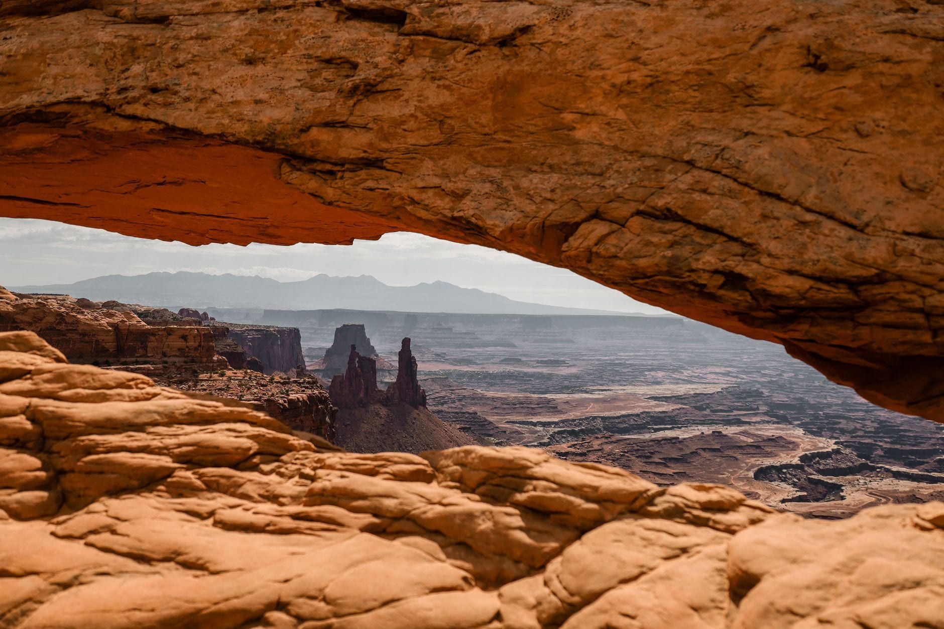
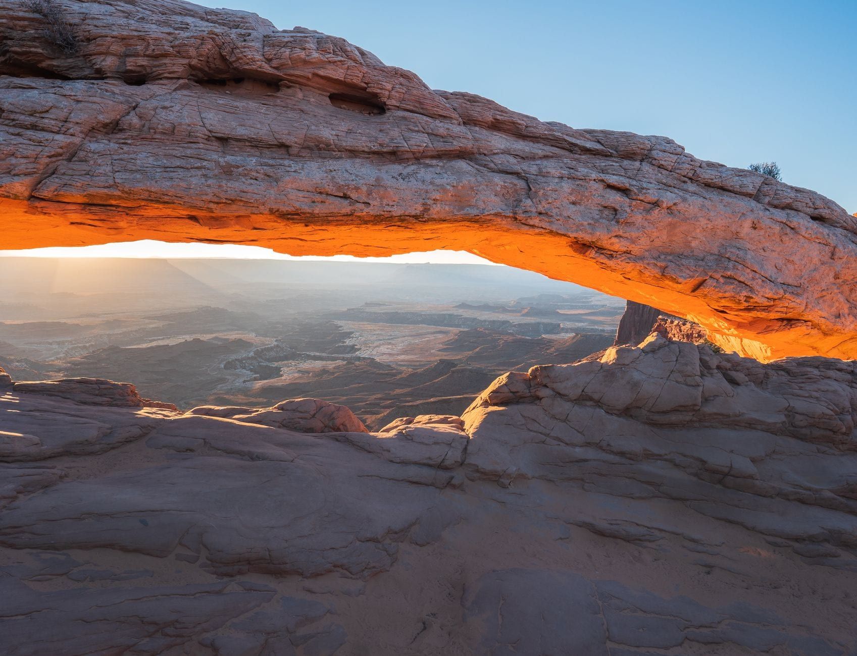
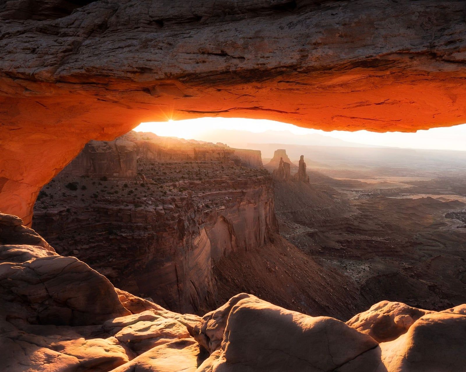
Mesa Arch is a 0.5-mile loop that takes about 30 minutes, and it's the one hike everyone does. At sunrise the first light passes under the arch's span and sets the rock glowing from beneath, with the La Sal Mountains on the horizon. That show draws tripods by the dozen: photographers stake out spots 30 to 45 minutes before sunrise, and the crowd is significant even on off-season weekdays. Arrive early or don't bother with sunrise at all — by mid-morning the arch is backlit and flat, though the loop itself stays worth half an hour.
Grand View Point and White Rim Overlook
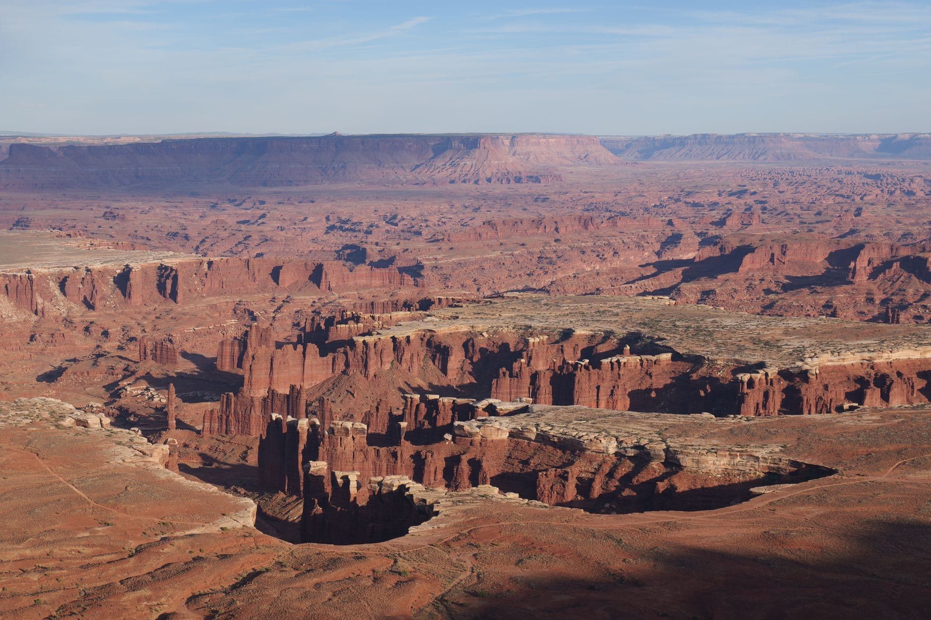
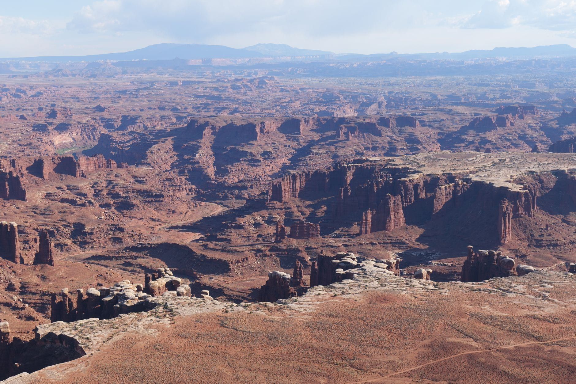
Grand View Point is a 1.8-mile round-trip walk, about 1.5 hours, along the canyon rim at the far south end of the drive. A paved sidewalk reaches the first viewpoint; the trail then follows the cliff edge to a second, with the White Rim Road visible 1,000 feet below and the Maze and Needles spread out to the horizon. Rangers give geology talks here spring through fall. We cover it in detail in our Grand View Point guide.
White Rim Overlook matches Grand View's distance — 1.8 miles round trip — but faces east, so it belongs in the late afternoon when low sun fills Monument Basin and lights the Colorado River bend. Parking at the trailhead is very limited, so if the lot is full, do Grand View instead and come back later.
Upheaval Dome
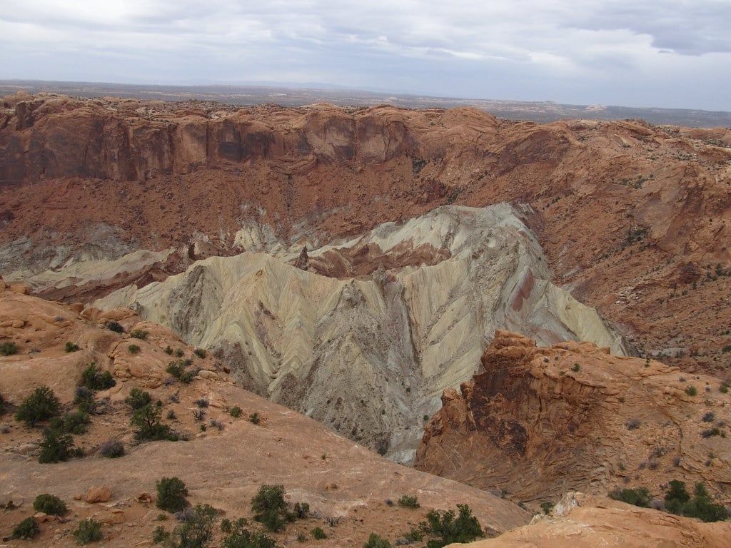
Upheaval Dome looks like a bull's-eye crater a mile and a half wide, and nobody has settled how it formed: a collapsed salt dome, or a meteorite impact. Exhibits at the first overlook argue both sides. The walk in is 0.6 miles with a 100-foot climb, about 30 minutes; a second overlook adds a mile and is worth it for the fuller view into the jumbled center. Pair it with the strenuous Syncline Loop below if you have a whole day.
Aztec Butte
Aztec Butte is 1.4 miles round trip with a 225-foot climb, and the last stretch is slickrock scrambling up the dome's rounded back. The payoff is two ancestral Puebloan granaries tucked under ledges near the top — some of the most accessible archaeology in the park. The rules are strict and rangers enforce them: don't enter the structures or climb on them, and leave everything where it sits. If you're steady on rock, this beats a fourth viewpoint.
Whale Rock and Murphy Point
Whale Rock is a 0.8-mile climb up a bare sandstone dome with steep drop-offs on both sides — kids love it, nervous adults don't. Murphy Point is the quiet one: 3.4 miles round trip, about 2 hours, out to an overlook above the Green River with barely any company. Both sit near the Upheaval Dome turnoff, so you can bundle all three in a morning.
Island in the Sky Strenuous Hikes: Below the Rim
Every trail in this section drops 1,000 to 1,600 feet off the mesa and has to climb back out, which changes the math entirely. Mesa-top walks let you quit anytime; rim trails commit you to the full distance in desert heat with no water and no shade. Carry a gallon per person, start early, and treat the listed times as minimums in warm weather.
Gooseberry Trail
Gooseberry is the steepest trail in the district: 4.6 miles round trip, descending 1,400 feet on switchbacks to the White Rim bench. The climb out is Grand Canyon-style — exposed, grinding, and about twice as long as it looks from the top. Go at dawn, bring more water than you think you need, and don't plan anything else for the afternoon.
Syncline Loop
The Syncline Loop circles Upheaval Dome in 8.1 miles with 1,300 feet of elevation change, and it's where most rescues in the park happen. The route crosses boulder fields, loses the trail in places, and bakes in afternoon sun. NPS advice for doing it right: hike clockwise for more afternoon shade, carry extra water, and bring a map and a flashlight — the loop routinely takes longer than people expect, and the final climb out in fading light is a common rescue trigger. Fit hikers with navigation skills will find it the most interesting terrain on the mesa. Everyone else should stick to the overlooks.
Alcove Spring and Lathrop Trails
Two full-day descents round out the district. Alcove Spring runs 11.2 miles round trip, 6 to 7 hours, dropping 1,300 feet past a large alcove to the base of the Moses and Zeus towers — the park's best-known climbing spires. Lathrop is 11.8 miles round trip with a 1,600-foot drop to the White Rim Road. Both are dawn starts, both need a gallon of water, and both leave you sore the next day.
Fort Bottom
Fort Bottom is 3.4 miles round trip to an ancestral Puebloan tower above a bend in the Green River, and you can't drive to it: the trailhead sits along the White Rim Road, which requires a high-clearance 4WD in low range plus a $6 day-use permit. The walk itself is easy once you're there. For most visitors this one is a future trip — or a reason to book a White Rim tour.
The Needles: Canyonlands' Best Hiking
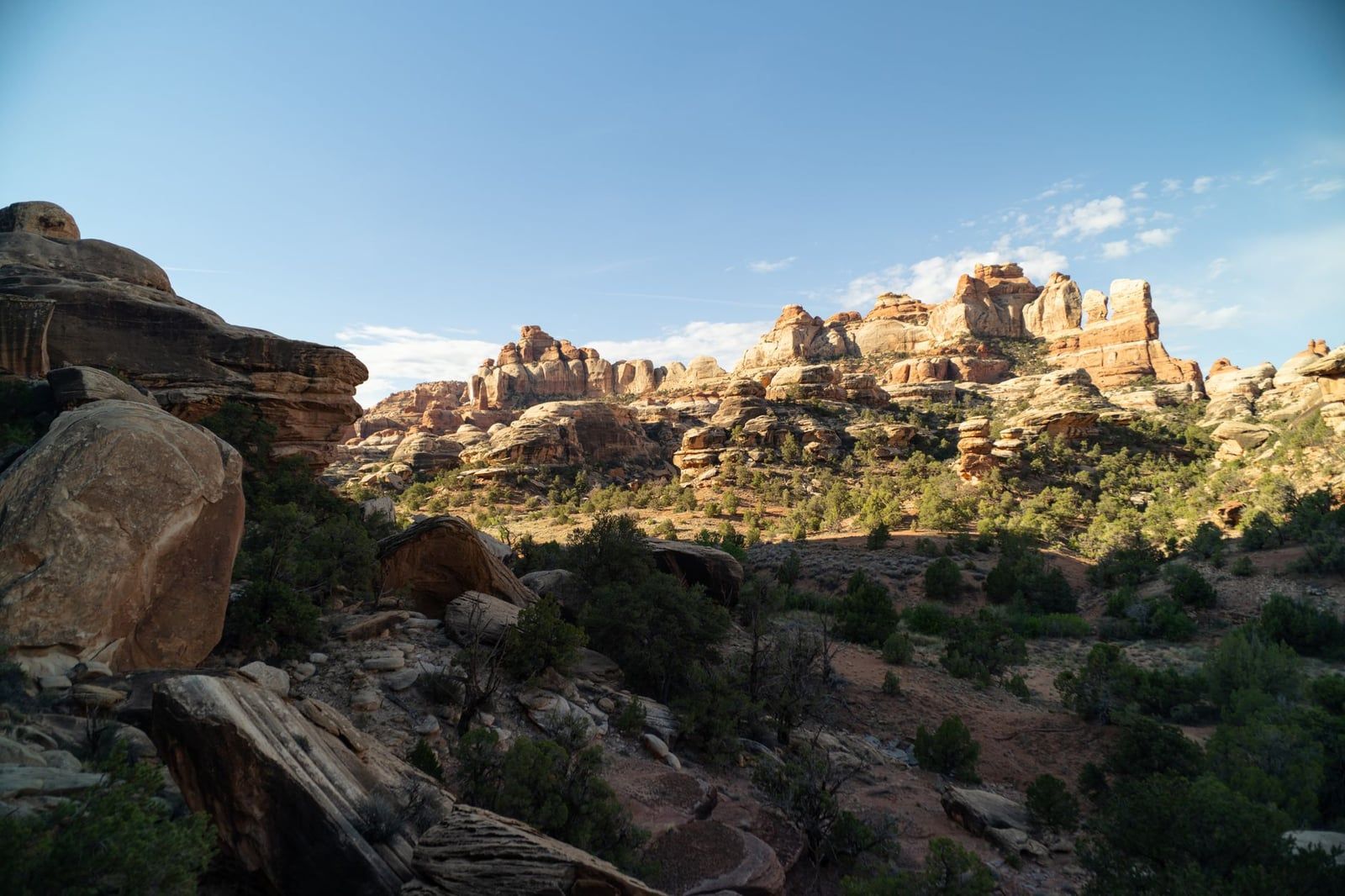
The Needles district is named for its spires — fins of Cedar Mesa Sandstone eroded into striped needles hundreds of feet tall — and the trails run between them rather than above them. That difference is the whole appeal: instead of looking down from a rim, you walk through the formations, in and out of shade, on slickrock and sand. Our Needles guide covers the campground and logistics; here are the trails.
Chesler Park Loop and the Joint Trail
The Chesler Park Loop with the Joint Trail is the signature hike in Canyonlands: 10.7 miles round trip, 5 to 7 hours, from the Elephant Hill trailhead. Chesler Park itself is a grassland ringed by spires, and the Joint Trail section runs through deep, narrow rock fractures — slot canyons on foot, cool and dark at midday. Moderate hikers have an official out: the Chesler Park Viewpoint option, 5.8 miles round trip in 3 to 4 hours, which ends at a pass looking down into the grassland without the full loop. In summer the loop often exceeds 100°F, so it's a very early start or nothing.
Druid Arch
Druid Arch is 10.8 miles round trip, 5 to 7 hours, ending at an 85-foot sandstone arch that looks like a standing stone from another planet. The final quarter mile is steep, with one ladder and some scrambling — leave it in your legs. Most of the route shares the Chesler Park trail before branching down Elephant Canyon, so you get spire views and a destination payoff in one walk.
Confluence Overlook
Confluence Overlook is 11 miles round trip, 5 to 6 hours, ending at a cliff where the Green and Colorado rivers merge 1,000 feet below. You hear the rivers before you can pick out the channels. The trail stays high the whole way across open slickrock, so it's brutally hot after mid-morning in warm months — carry the full gallon.
Short Trails: Cave Spring, Pothole Point, Slickrock
If the big hikes don't fit your day, three short self-guided trails along the scenic drive cover the district's character in under an hour each. Cave Spring is a 0.6-mile loop, about 45 minutes, with two ladders, a historic cowboy camp under a ledge, and prehistoric rock art panels. Pothole Point is 0.6 miles in about 40 minutes, winding past depressions in the rock that hold tiny ecosystems after rain — step around them, not through them. Slickrock is 2.4 miles over bare rock with 360-degree views and markers you follow like a scavenger hunt. All three suit families.
Elephant Hill and Repeat-Visitor Loops
Elephant Hill is the trailhead for Chesler Park and Druid Arch, and also a 4WD road famous for its tight switchbacks — driving it requires a day-use permit ($6 online the day before, free same-day at the visitor center). Repeat visitors with map skills can build their own loops through Big Spring, Lost Canyon, and Wooden Shoe — the interconnecting trail network makes combinations nearly endless. That's the district's real depth: you can walk here for a week without repeating a route.
The Maze and Horseshoe Canyon: For the Few
The Maze deserves its name. Trails are steep, unmarked, and minimally maintained; route-finding is genuinely difficult; trailheads sit at the end of high-clearance 4WD tracks 162 miles from Moab. Most Maze routes — the Maze Overlook, Harvest Scene, the Dollhouse — are multi-day backpacking trips, and the Dollhouse is realistically reached by rafting the Colorado through Cataract Canyon. Our Maze guide explains what planning actually requires. If you're not that person, there's still one exception.
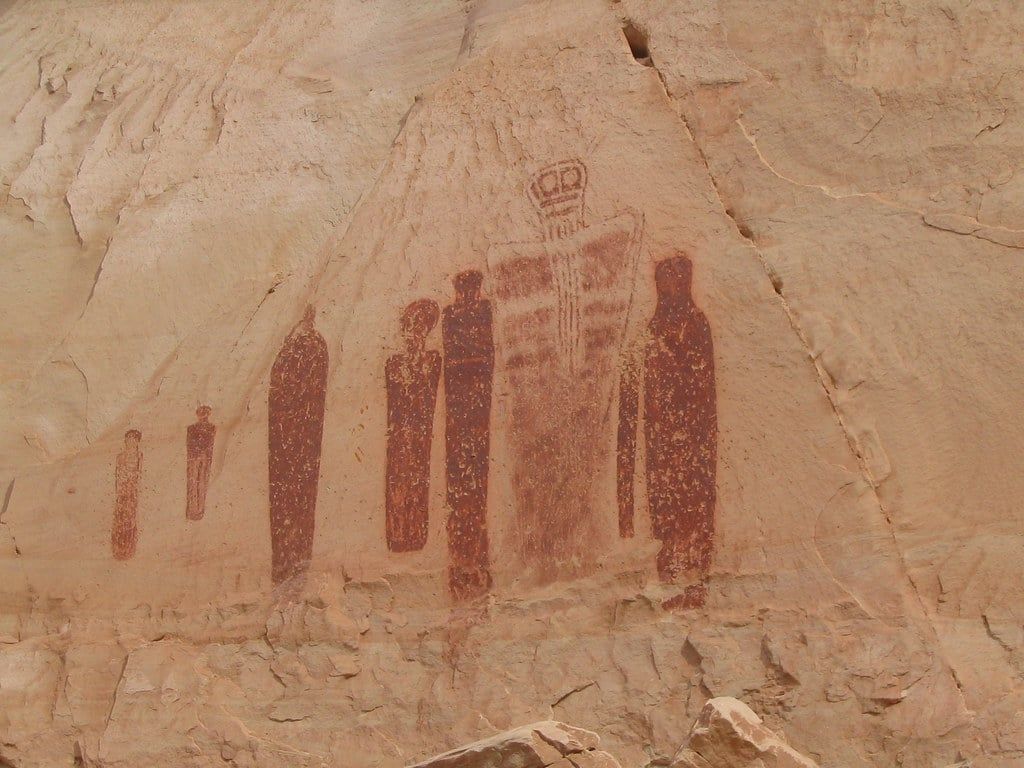
Horseshoe Canyon and the Great Gallery
Horseshoe Canyon is a detached unit of the park, a day trip from Moab via dirt roads, and the one Maze-area hike ordinary visitors can do. It's 7 miles round trip, 4 to 5 hours, starting with a 780-foot descent to a sandy canyon bottom. Along the way you pass petroglyph and pictograph sites, culminating in the Great Gallery: life-sized painted figures in Barrier Canyon style, made roughly 2000 BCE to 500 CE, and among the most significant rock art panels in North America. The canyon is exposed with minimal shade — NPS flags it as dangerously hot in summer, when you should start very early or after 4 pm and carry a light for the climb out. And do not come after rain: the access road becomes impassable and flash floods are a real danger.
Matching Hikes to Your Trip
Six trails cover most trip plans. Here's the short version, then the day plans.
| Trail | District | Round trip | Difficulty | Best time |
|---|---|---|---|---|
| Mesa Arch | Island in the Sky | 0.5 mi | Easy | Sunrise |
| Grand View Point | Island in the Sky | 1.8 mi | Easy | Morning or evening |
| Upheaval Dome (both overlooks) | Island in the Sky | 1.6 mi | Easy–moderate | Any |
| Syncline Loop | Island in the Sky | 8.1 mi | Strenuous | Dawn, clockwise |
| Chesler Park Viewpoint | The Needles | 5.8 mi | Moderate | Early start |
| Horseshoe Canyon | Maze area | 7 mi | Moderate | Early or after 4 pm |
One Day: Island in the Sky Circuit
Start at Mesa Arch 30 to 45 minutes before sunrise — you'll want the front row and the parking is tight. After the arch, drive south to Grand View Point while the morning light is still low, walk the rim trail, then backtrack to White Rim Overlook as the sun climbs. Spend the afternoon at Upheaval Dome, adding Whale Rock or Aztec Butte if your legs agree, and finish with a second pass at White Rim Overlook in the late-afternoon light. That's a full and varied day, and nothing on it exceeds 2 miles.
Two to Three Days: Add the Needles
Day two belongs to the Needles — it's about 90 minutes from Moab and deserves a full day. Moderate hikers take the Chesler Park Viewpoint (5.8 miles); strong hikers do the full loop with the Joint Trail (10.7 miles). Either way, start early, and finish with the Cave Spring loop if you have an hour left. With a third day, return to Island in the Sky for a below-the-rim trail — Gooseberry if you want steep and short, Alcove Spring if you want a long one — or add Druid Arch as a second Needles day.
When to Go
April through May and mid-September through October are the prime months: highs of 60–80°F, cold nights, and the busiest trails and campgrounds of the year. July and August average 100°F highs with monsoon storms from July onward — rangers responded to 23 heat-related search-and-rescue incidents across Arches and Canyonlands in one recent summer — so if you're stuck with summer, hike at dawn and be off slickrock by 11 am. December through February can bring snow that makes unpaved roads impassable, but the park is quietest then and the Needles Visitor Center closes for winter. More detail is in our best time to visit Canyonlands guide.
Safety, Water and Trail Rules
Water is the rule that matters most. NPS guidance: at least 1 quart (1 liter) per person on short trails, up to 1 gallon (4 liters) on long ones — and in summer heat, more. There is no potable water on any trail in the park; fill up at the visitor center or your campground. Carry a map and a flashlight on anything long, plus basic first aid.
Navigation is on you. Trails are marked with cairns — stacked rock piles — but many remote routes are not well maintained, and cell coverage is limited in some areas and nonexistent in many. Every backcountry hiker should carry a topographic map; don't count on a phone.
Then the rules that get cited. Climbing on, scrambling over, or standing on any arch is prohibited — that includes Mesa Arch, no matter how good the photo looks. Don't enter or climb on ruins and granaries. Step around potholes; the small ones hold living ecosystems. Pets are barred from all trails, overlooks, and the backcountry — leashed dogs are allowed only in campgrounds (Willow Flat, Squaw Flat), on roads, and in parking areas. Overnight trips require a backcountry permit, and backpackers should check in with rangers first, because the terrain is desolate and far from any help. Flash floods and rain-killed dirt roads are the desert's quiet traps: check the forecast before entering washes, and never drive a wet unpaved road.
Frequently asked questions
What is the best hike in Canyonlands National Park?
Mesa Arch is the iconic short walk (0.5-mile loop, about 30 minutes, best at sunrise), and Grand View Point is the best easy panorama at 1.8 miles. For a full day, the Chesler Park Loop with the Joint Trail — 10.7 miles, 5 to 7 hours through narrow rock fractures — is the park's signature hike.
Which district of Canyonlands should I visit?
First-timers: Island in the Sky, 32 miles from Moab, for big views and short trails. Hikers who want immersion and fewer people: the Needles, about 90 minutes south, with 60-plus miles of interconnecting trails. The Maze is expert 4WD and backpacking territory — don't plan it as a casual day trip.
How many days do you need in Canyonlands?
One day covers Island in the Sky's highlights — Mesa Arch, Grand View Point, White Rim Overlook, and Upheaval Dome. Add one to two days for the Needles, which sits about 90 minutes from Moab and needs its own day.
Do you need a permit to hike in Canyonlands?
No permit is needed for day hikes. Overnight backcountry trips require a permit ($36 reservation fee plus $5 per person per night), and day use of certain 4WD roads like White Rim and Elephant Hill requires a $6 permit (free if obtained same-day at a visitor center).
Are dogs allowed on Canyonlands trails?
No. Pets are prohibited on all trails, at overlooks, and in the backcountry. Leashed pets are allowed only in developed campgrounds (Willow Flat, Squaw Flat), on paved roads, and in parking areas.
How much water should I carry hiking in Canyonlands?
Per NPS guidance, at least 1 quart (1 liter) per person on short trails and up to 1 gallon (4 liters) on long ones — more in summer heat. There's no water on any trail, so also pack sun protection, a map, and a flashlight.
How do I avoid crowds at Mesa Arch?
Arrive 30 to 45 minutes before sunrise to claim a spot; the arch's first light draws photographers even on off-season weekdays. Winter weekdays are the quietest it gets.
Is the Syncline Loop Trail dangerous?
It's where most park rescues happen. The 8.1-mile loop has 1,300 feet of climbing plus boulder scrambling, and people routinely underestimate it. Hike clockwise for afternoon shade, carry extra water, and bring a map and flashlight.