Island in the Sky is the part of Canyonlands National Park you can actually do in a day. It's a broad mesa at 5,930 feet, walled by sandstone cliffs that drop more than 1,000 feet on every side, and it delivers the biggest views in Utah's largest national park with the least walking of any district. Nearly every first-time Canyonlands visit happens here.
This guide covers the logistics, the overlooks and hikes worth your time, and a lighting-driven one-day plan that sequences the stops the way a local would run them. If you're pairing Canyonlands with its neighbor up the road, our Arches vs Canyonlands comparison sorts out how to split your days.
What Is Island in the Sky?
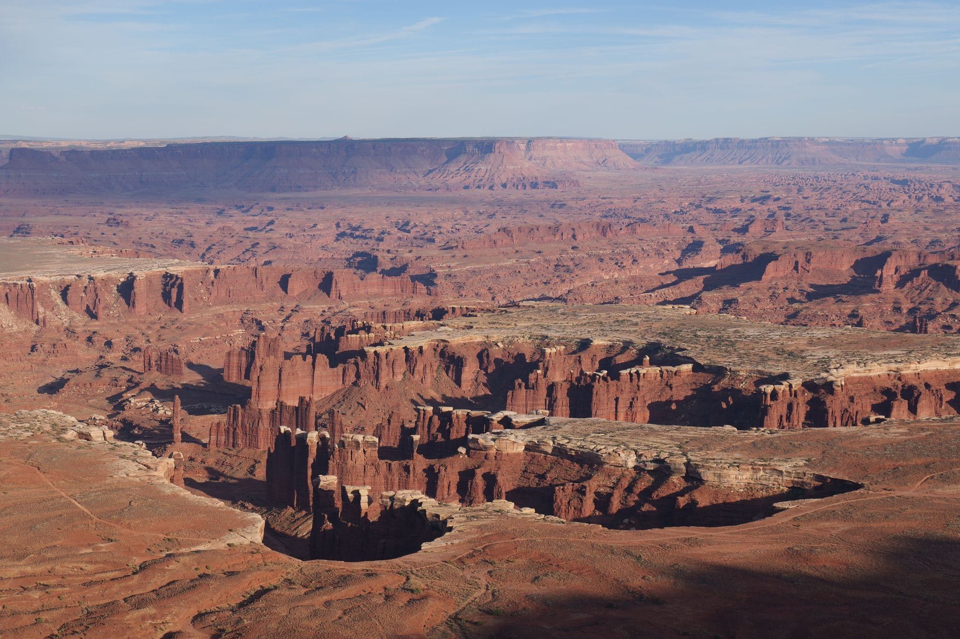
The district is a triangular wedge of mesa standing between the Green and Colorado rivers, attached to the mainland by a narrow neck of rock. Every overlook looks down on the White Rim, a bench of resistant sandstone roughly 1,200 feet below the mesa top, with the rivers another 1,000 feet below that. The scale takes a minute to register — you're looking across canyons that took hundreds of millions of years of sediment and river work to build.
Getting around is simple. One paved scenic drive runs down the spine of the mesa, with two spur roads: Grand View Point Road to the south and Upheaval Dome Road to the west. Pullouts line the route, most a short walk from parking. That geometry — big views, minimal walking — is why this district sees the crowds while the rest of the park stays quiet, and why it's the right call for a first visit: the visitor center is about 40 minutes from Moab.
Canyonlands' other districts are separate trips, not add-ons. The Needles, the next most visited, is a two-hour drive (106 miles) from the Island in the Sky Visitor Center because no roads connect the districts inside the park — our Needles district guide makes the case for giving it its own day. The Maze is one of the most remote areas in the lower 48 states and demands backcountry experience; the Maze guide covers what that takes.
Getting There, Fees & Park Logistics
From Moab, drive 10 miles north on US-191, turn onto UT 313, and continue 22 miles southwest to the visitor center — about 40 minutes total. The NPS strongly recommends a paper map, because navigation apps sometimes route drivers onto the wrong roads out here. Our directions to Canyonlands page covers approaches from Salt Lake City, Grand Junction, and elsewhere.
Entry is $30 per private vehicle, valid seven days, and the entrance station takes credit and debit only. A $55 Southeast Utah Parks pass covers Canyonlands, Arches, Natural Bridges, and Hovenweep — usually the better buy on a Moab trip that includes both big parks. The $80 America the Beautiful pass covers all federal lands. There is no timed entry and no reservations; just drive in.
The Island in the Sky Visitor Center is open year-round, roughly 9 a.m. to 4 p.m., with reduced winter hours (closed December 25, and open only Friday through Tuesday between early January and early March). It's the district's one reliable water source, has exhibits and rangers, and runs seasonal ranger programs including geology talks at Grand View Point. There are no electrical outlets.
Plan around what the park doesn't have. No restaurants or food sales, no gas, no shuttle — you need your own car or a tour. Restrooms sit at the main viewpoints and trailheads. Cell service is essentially useless, and the visitor center's Wi-Fi is your only connectivity, so download offline maps before you leave Moab. Grab the official NPS Island in the Sky roads-and-trails map while you're at it.
Best Time to Visit & Beating the Crowds
April through May and mid-September through October are the sweet spots: daytime highs average 60-80°F and every trail on the mesa top is comfortable. July averages 100°F (the record is 116°F), with monsoon storms in July and August that bring flash-flood risk to the canyons. Winter highs run 30-50°F with lows of 0-20°F — quiet, but cold at dawn.
Crowd tactics matter more than season. Get through the entrance before 10 a.m.; the station line builds midday on weekends and in peak season. Mesa Arch draws a tripod line at dawn and stays busy all day. The Grand View Point lot fills by midday. Late October into early November gives you near-peak weather with noticeably thinner crowds than fall-break October, and weekdays beat weekends at any time of year. Our best time to visit Canyonlands guide has the month-by-month detail.
Two caveats worth planning around. In winter, small amounts of snow or ice can close roads temporarily and leave rim trails slick — microspikes help — and Moab businesses cut hours from November until spring break. And rain degrades the dirt roads fast: check the park's road conditions page before driving Shafer Trail or anything unpaved.
The Best Overlooks in Island in the Sky
Six overlooks earn their stop, ordered here roughly as you'd drive them. All are paved-access and doable in any car. If you only have time for one, make it Grand View Point.
Visitor Center Overlook
The first wow moment sits across the road from the visitor center parking lot. A flat, minutes-long walk puts you at the cliff edge, staring down into Shafer Canyon country — a useful preview of whether the district's scale will eat your schedule (it will).
Shafer Canyon Overlook & Shafer Trail Viewpoint
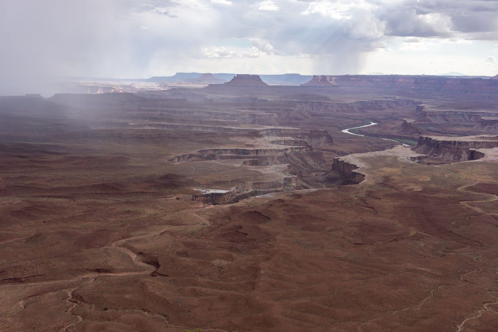
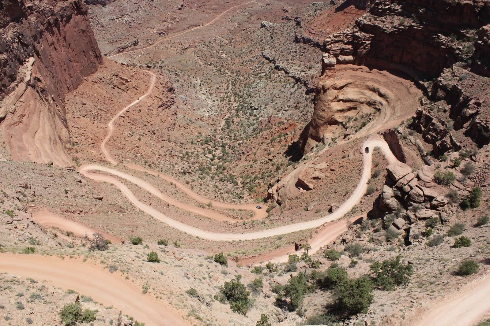
Two stops, one view system: the Shafer Trail's switchbacks, dropping more than 1,500 feet off the mesa in a series of carved turns. The Shafer Trail Viewpoint gets you closest to the road itself — watch for 4WD vehicles inching down the cliff face while you stand safely at the rail. Both are roadside pullouts with no walking required.
Green River Overlook
A 0.1-mile paved walk looks west over Soda Spring Basin and the Green River's entrenched meanders. The view faces the setting sun, which makes this the classic sunset pick — arrive 30 minutes early in peak season, since the lot is small.
Buck Canyon Overlook
The quickest stop on the list: a short paved path to a 180° view over Buck Canyon toward the La Sal Mountains. Five minutes, no effort, and worth every one of them.
Grand View Point
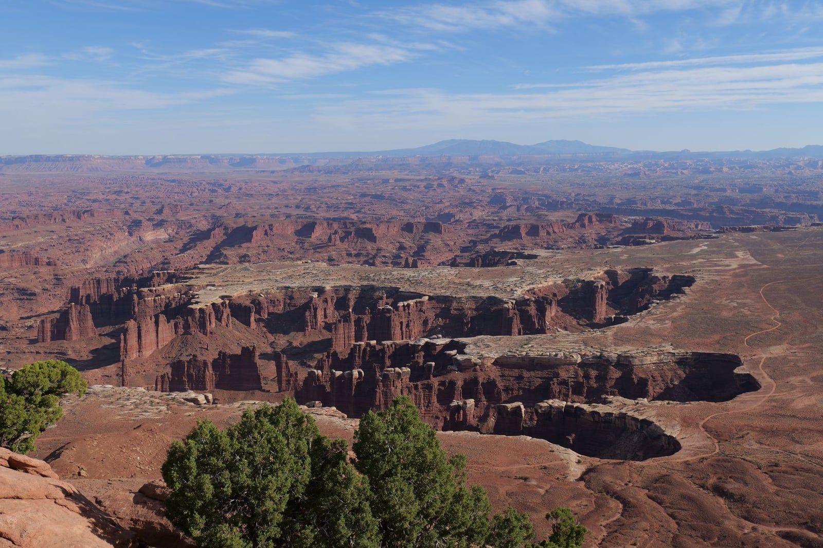
The finale. At the end of Grand View Point Road, a paved sidewalk reaches a viewpoint over Monument Basin, the canyons of the Colorado, and — on clear days — features in the Maze and Needles districts. Rangers give geology talks here spring through fall. Our Grand View Point guide covers the optional two-mile rim trail beyond the viewpoint. The lot fills midday; late afternoon is both emptier and better lit.
Candlestick Tower Overlook
An unmarked pullout on the west side of the road with parking for about four cars and a short walk to the rim. The Candlestick Tower spire catches the last light while most visitors are already back in Moab. It's the district's worst-kept local secret — and its best sunset when Green River Overlook is full.
| Overlook | Walk from car | Time needed | Best light |
|---|---|---|---|
| Visitor Center Overlook | 5 min, flat | 10-15 min | Any |
| Shafer Canyon / Trail Viewpoint | Steps | 10-20 min | Morning |
| Green River Overlook | 0.1 mi, paved | 20-30 min | Sunset |
| Buck Canyon Overlook | Short paved path | 10 min | Midday |
| Grand View Point | Short paved walk | 30-60 min | Late afternoon |
| Candlestick Tower pullout | Short walk | 15-20 min | Sunset |
The Best Hikes in Island in the Sky
Every trail here is either a short mesa-top walk or a serious descent below the rim — there's no in-between. No trail has shade. More detail on all of them is in our Canyonlands hikes guide.
Mesa Arch
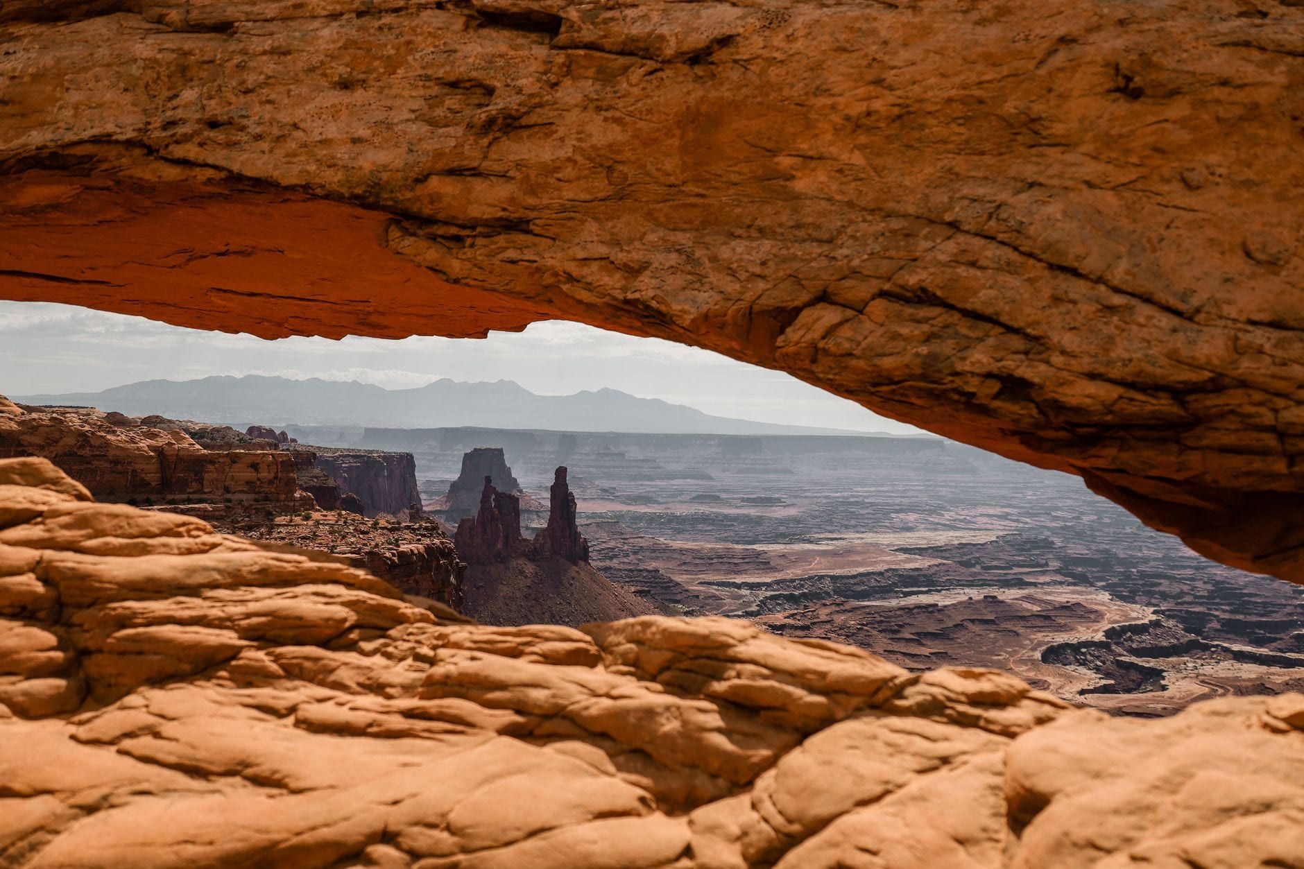
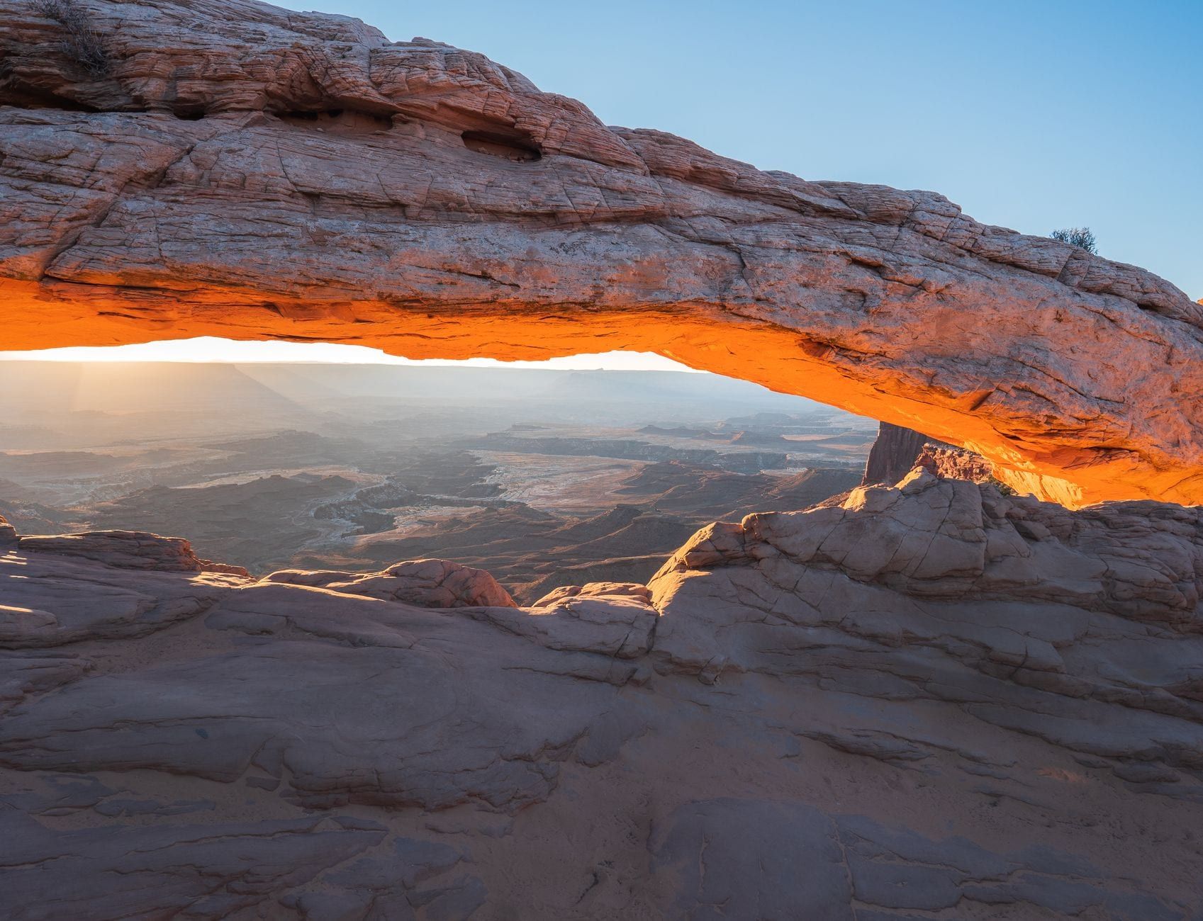
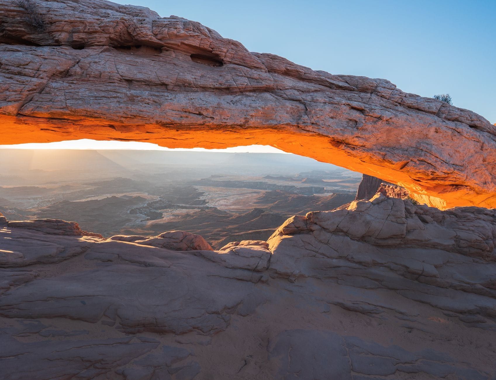
A 0.5-mile round trip, easy, about 30 minutes. At sunrise the sun crests the La Sal Mountains and the arch's underside glows red-orange — the phenomenon that fills the parking lot with photographers before dawn. Arrive 45-60 minutes early in spring and fall or you'll park down the road. Don't climb on the arch: it's unsafe and ruins the shot for everyone lined up behind you. Worth visiting any time of day, but sunrise is the whole point.
White Rim Overlook
The best view-per-effort hike in the district: 1.8 miles round trip, easy, ending at a panorama over Monument Basin and Buck Canyon with a fraction of Mesa Arch's crowd. The catch is parking — the trailhead shares a small picnic-area turnoff 11 miles from the visitor center, and it holds only a handful of cars. Go early or late.
Upheaval Dome
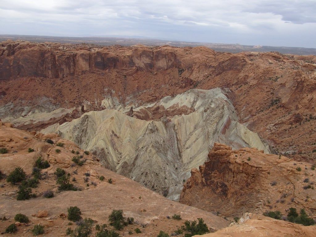
A steep 0.6-mile trail (about 30 minutes) reaches the first overlook of a mile-wide, bull's-eye crater whose pink and grey rock looks nothing like the rest of the district. Nobody agrees on how it formed: the leading theories are a meteorite impact and a collapsed salt dome. A second overlook adds a mile and a better sense of the crater's scale. Midday's harsh light matters least here, which is exactly why the itinerary sends you at noon.
Grand View Point Trail
Two miles round trip along the rim past the paved viewpoint to a second, quieter one. Easy walking, exposed the whole way. Skip it if you're short on time — the paved overlook delivers most of the payoff — but take it in late afternoon, when the deepening shadows do more for the canyon than any other hour.
Whale Rock & Aztec Butte
Whale Rock is a 1-mile round trip up a rounded slickrock dome — kids love it, and the views from the top stretch across the mesa. Aztec Butte is a 2-mile round trip with a short scramble up the butte itself to ancestral Puebloan granaries tucked under the rim, plus views into Taylor Canyon. Both sit off Upheaval Dome Road, so they chain naturally with the crater hike.
Below the Rim: Gooseberry & Syncline Loop
These are the two ways down, and neither is casual. Gooseberry is the steepest trail in the park, dropping more than 1,000 feet in under a mile — about 4.2 miles round trip with roughly 1,500 feet of climbing back out. The Syncline Loop circles Upheaval Dome for 8.5 miles and 2,050 feet of ascent on primitive, cairn-marked trail; budget 5-7 hours. Both are for fit hikers with plenty of water, started early. Summer, forget it.
Wherever you walk: stay on trail, pack out everything, and leave the cairns and rock art alone. The desert doesn't forgive shortcuts.
One Perfect Day in Island in the Sky (Hour by Hour)
The trick to this district is sequencing it by light. Sunrise belongs to Mesa Arch; midday, when the rim views go flat, belongs below the rim at Upheaval Dome; the east-facing rim stops come alive as shadows deepen in late afternoon; and sunset goes west to Green River Overlook. Run it in that order and every stop shows up at its best.
| Time | Stop | Why |
|---|---|---|
| Pre-dawn | Mesa Arch | Arrive 45-60 min before sunrise for parking and a front-row spot |
| Morning | Shafer Canyon overlooks | Calm lots, low-angle light on the switchbacks |
| Midday | Upheaval Dome + Whale Rock | Harsh light doesn't matter below the rim |
| Early afternoon | Picnic lunch | Tables at the White Rim trailhead and visitor center |
| Late afternoon | White Rim Overlook hike or Grand View Point | Deep shadows bring the canyons alive; lots are emptying |
| Sunset | Green River Overlook | Classic west-facing sunset; Candlestick Tower as backup |
Shorter on time? The NPS benchmarks are honest: with one hour, drive to Grand View Point. With two hours, add Green River Overlook and the Mesa Arch loop. With a half day, do Mesa Arch, Grand View Point, and one more overlook, in that order.
Bring the picnic — there's no food for sale anywhere in the park, and the picnic tables at the White Rim Overlook trailhead make a better lunch spot than any restaurant anyway. After sunset, it's a 30-40 minute drive back to Moab for dinner.
Beyond the Mesa Top: White Rim Road, Shafer Trail & River Adventures
Everything beyond the paved loop sorts neatly by what you're driving and what you're willing to organize. A regular 2WD car covers the entire district described above. Beyond that, three tiers.
White Rim Road
A 99-mile loop on the sandstone bench between the mesa top and the rivers, run by high-clearance 4WD with low range (AWD and 2WD vehicles are not permitted) or by mountain bike. Driving it takes 2-3 days; biking, 3-5. Every vehicle needs a permit — $6 for day use, or an overnight backcountry permit — and a disabled vehicle means commercial towing that can exceed $1,000. Worth it only as a committed trip you plan months ahead, not a spontaneous detour.
Shafer Trail & Potash Road
The middle tier: the 1,500-foot switchbacks you stared at from the overlook, driven. About 19 miles of unpaved road from the mesa top down to the White Rim junction and Potash Road, looping back to Moab in roughly two hours. No permit needed, but a high-clearance 4WD with low range is strongly recommended, and ATVs and UTVs are prohibited in the park. Stop at Thelma & Louise Point — the cliff from the film's final scene — on the Potash side. Check road conditions first; rain closes it.
On the Rivers
Upstream of the confluence, the Colorado and Green are flatwater — kayakers and canoeists paddle them on multi-day trips with river permits ($36 reservation fee plus $25 per person). Downstream, Cataract Canyon drops through 14 miles of Class III-V whitewater, run by Moab outfitters on multi-day raft trips. Both are their own expeditions, not day add-ons from the mesa.
Dark Skies, Stargazing & Flights
Canyonlands is a certified International Dark Sky Park, and the park never closes — stay for the stars and you'll see the Milky Way the way the desert shows it. Rangers run telescope astronomy programs in season. You can't use artificial light to illuminate the landscape for photos, and drones are banned outright. If you'd rather see the district's scale than its dirt roads, Canyonlands airplane tours from Moab put the whole White Rim and river confluence under you in an hour.
Dead Horse Point State Park
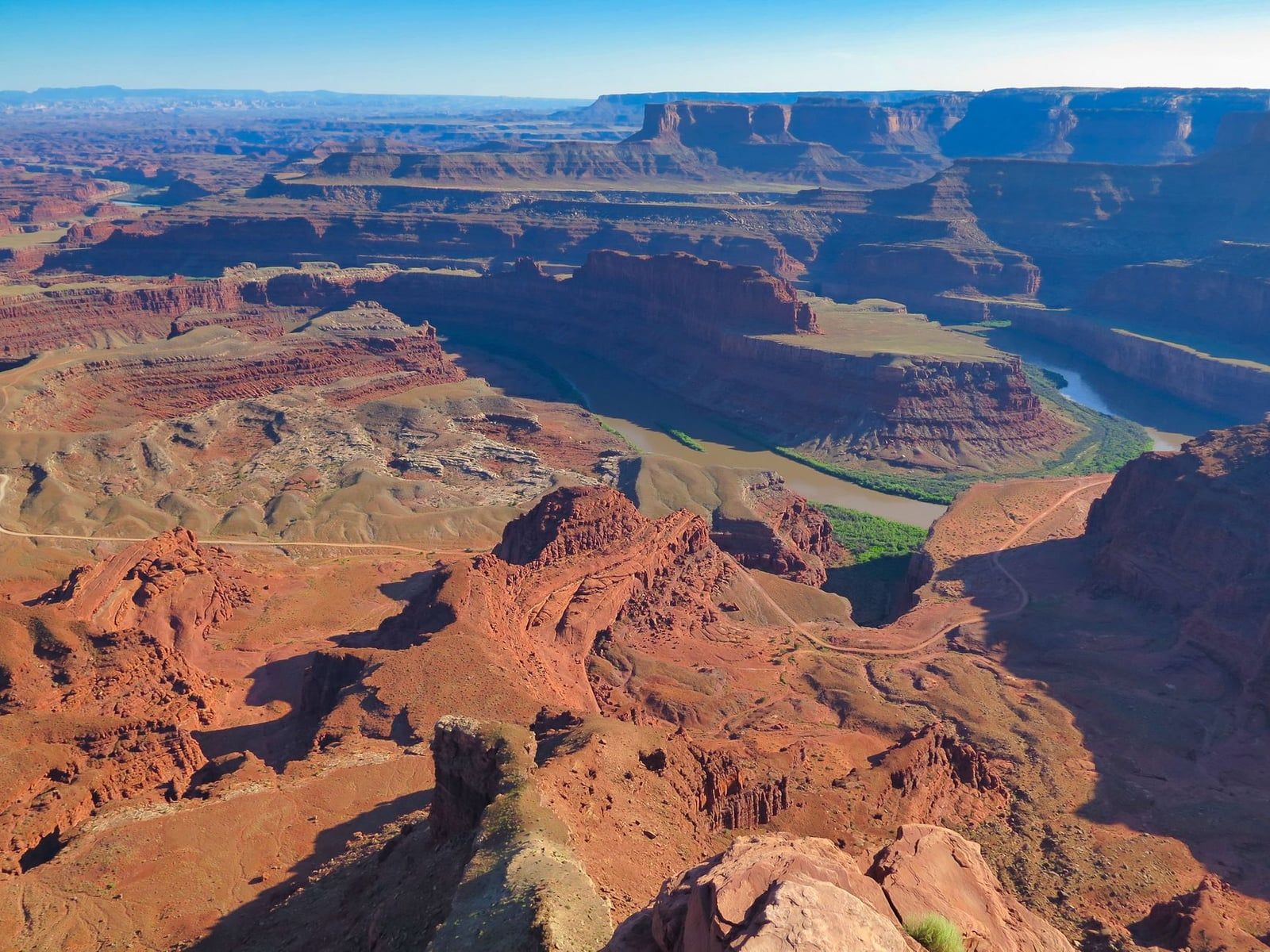
The easy add-on: it sits on UT 313 on the drive in, and its rim overlook — where the Colorado River loops 2,000 feet below — is one of the most photographed views in the country. Entry is $20 per vehicle, and your national park pass doesn't work here; it's a state park. Budget an hour. Pair it with your outbound or return drive and you lose almost no time.
Where to Stay, Eat & What to Pack
Moab is the base for almost everyone: 30-40 minutes from the visitor center, with the full run of hotels, vacation rentals, restaurants, and grocery stores. There's no lodging in the park at all — Moab, Monticello, and Hanksville are the closest beds, and Moab is the only practical one for Island in the Sky.
The district's only campground is Willow Flat, 12 first-come, first-served sites at $15 a night with pit toilets, fire rings, and no water. It fills fast spring through fall — arrive by mid-morning or don't count on it. A stronger backup: Dead Horse Point State Park's Kayenta and Wingate campgrounds (21 and 31 sites, from $40-50 a night, electric hookups at Kayenta) sit on the road in and can be reserved.
Food is a packing problem. Nothing is sold in the park, so build the day around a picnic — stock up at a Moab grocery the night before — and plan dinner back in town.
The packing shortlist, driven by what the park lacks:
- Water — more than you think, refilled at the visitor center
- All food and snacks for the day
- Sun protection: hat, sunscreen, sunglasses (there is no shade)
- Layers for cold dawns, even in spring and fall
- Offline maps downloaded before you lose signal
Island in the Sky FAQ
The questions that come up most when planning a first visit:
Frequently asked questions
How many days do you need in Island in the Sky?
One day covers Mesa Arch, three or four overlooks, and a couple of short hikes. The NPS minimums: with 1 hour you can drive to Grand View Point; with 2 hours, add Green River Overlook and the Mesa Arch loop. A second day suits below-the-rim hikes or a permitted White Rim Road trip.
Can you visit Arches and Island in the Sky in one day?
It's possible — the two entrances are roughly 35 minutes apart — but rushed. You'd skip most hikes and fight entrance lines twice. A full day for each park is the better plan, and Arches may have its own timed-entry requirements in peak season.
Is Mesa Arch better at sunrise or sunset?
Sunrise, decisively. The arch's underside glows red as the sun crests the La Sal Mountains, which is why photographers line up before dawn — arrive 45-60 minutes early for parking. It's still worth a short stop any time of day if dawn doesn't work.
Do I need a permit or reservation to visit Island in the Sky?
No timed entry and no reservations — just the $30 per vehicle pass, valid seven days. Permits only apply to the White Rim Road ($6 day use or overnight backcountry permits), other 4WD roads, river trips, and Needles group campsites.
Can you explore Island in the Sky in a regular 2WD car?
Yes. Every overlook and short hike sits on the paved scenic drive. High-clearance 4WD is only needed for the Shafer Trail and White Rim Road, and ATVs and UTVs are prohibited in the park entirely.
What's the best overlook if I only have time for one?
Grand View Point — the widest panorama in the district, best in late-afternoon light, with an optional two-mile rim trail if you have more time. For sunset specifically, go to Green River Overlook instead.
Where should I stay to visit Island in the Sky?
Moab, 30-40 minutes away, with the full range of hotels and restaurants. Inside the district, the only option is Willow Flat Campground: 12 first-come, first-served sites at $15 a night with no water, so arrive early or reserve at Dead Horse Point State Park instead.
How do I avoid the crowds at Island in the Sky?
Enter before 10 a.m. to skip the entrance-station line, do Mesa Arch at dawn before the lot fills, save the Grand View Point Road stops for mid-afternoon as lots empty, and consider a winter weekday for near-solitude. Late October into early November is the best weather-crowd overlap.
Sources
- nps.gov/cany/planyourvisit/islandinthesky.htm
- nps.gov/cany/planyourvisit/itineraries.htm
- nps.gov/cany/planyourvisit/whiterimroad.htm
- nps.gov/cany/planyourvisit/fees.htm
- nps.gov/cany/planyourvisit/weather.htm
- nps.gov/cany/planyourvisit/permitsandreservations.htm
- en.wikipedia.org/wiki/Canyonlands_National_Park
- stateparks.utah.gov/parks/dead-horse-point