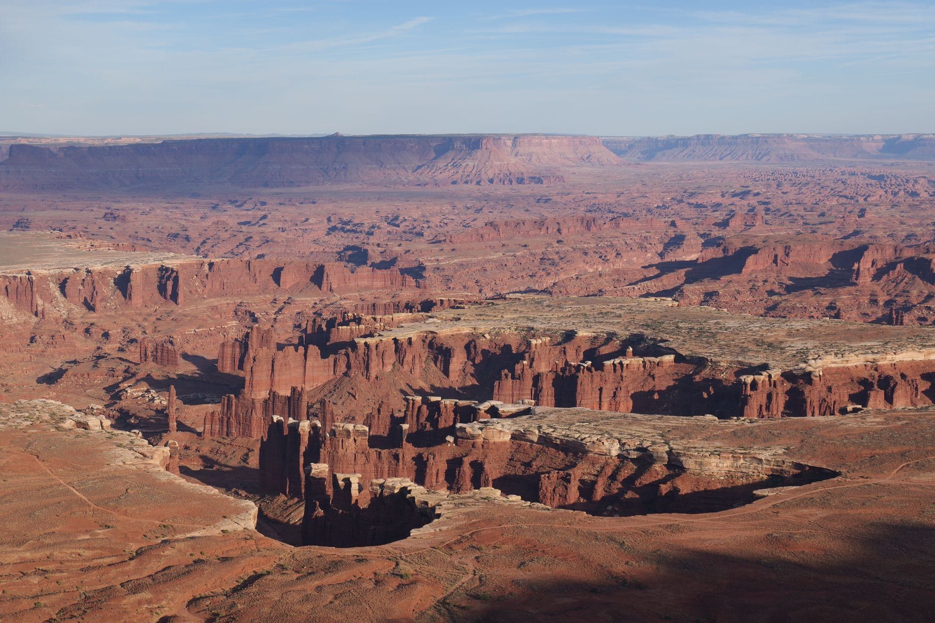
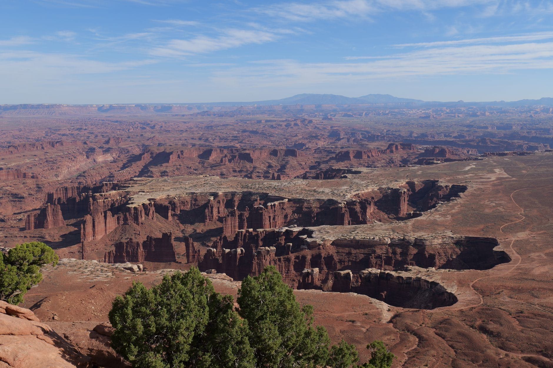
Grand View Point is the payoff at the end of the road — literally. Drive to the southernmost tip of Canyonlands' Island in the Sky mesa, walk a hundred yards on pavement, and the whole park opens below you: miles of corrugated canyons, the White Rim Road tracing a ledge a thousand feet down, the striped spires of the Needles far to the south. Ask anyone who has toured all four districts which single view they would keep, and most will name this one.
It's also the easiest big view in the park. The overlook sits steps from the parking lot, on a paved path that works for wheelchairs and strollers, and the optional rim trail beyond it is flat, short, and marked by stone cairns. This guide covers what you're actually looking at, how to get there, the 2026 construction closures that will shape late-summer trips, and how to slot the point into a day on the mesa.
What Is Grand View Point? Trail at a Glance
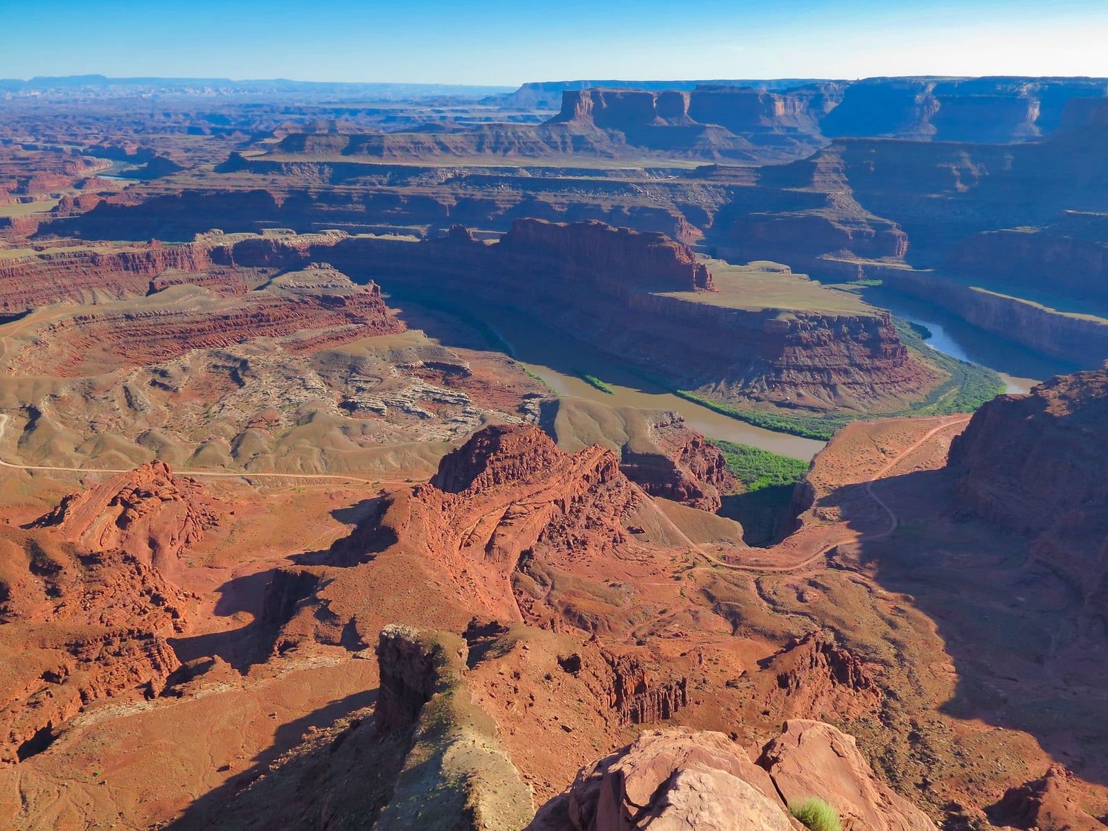
Grand View Point is the southernmost overlook in the Island in the Sky district, at the end of the mesa's scenic drive, and the view from it explains the park's name better than any brochure. From the paved viewpoint you stand about 1,200 feet above the White Rim Road, looking across a maze of canyons that the Green and Colorado rivers cut over millions of years. Is it worth the 12 extra miles of driving past the visitor center? Yes — this is the single view people remember from Canyonlands.
The numbers are friendly. The trail is an easy 1.8–2 mile out-and-back with roughly 70–127 feet of gain, and most people finish it in about an hour, including photo stops. The trailhead sits at GPS coordinates 38.3108, -109.8566.
| Detail | Info |
|---|---|
| Distance | 1.8–2 miles round trip (out-and-back) |
| Time & difficulty | About 1 hour; easy — flat, cairn-marked, ~70–127 ft of gain |
| Trailhead | End of the Island in the Sky scenic drive, 12 mi south of the visitor center (GPS 38.3108, -109.8566) |
| Entrance fee | $30/vehicle, $25/motorcycle, $15 on foot or bike — 7-day pass |
| Facilities | Vault toilets, RV/trailer parking; no water or food sold in the park |
| Dogs | Not allowed on any trail in the district |
One distinction drives every plan here: the paved overlook and the rim trail are two different experiences. Most visitors never go past the pavement — they take in the panorama from the main viewpoint and drive off. The unpaved trail continues about a mile along the narrowing mesa to a second viewpoint, and almost nobody walks it. If you have an hour and steady legs, walking it is the difference between looking at the canyon and standing inside its amphitheater.
What You Can See From Grand View Point
The panorama is so wide it reads as abstract until you can name a few features. Start at the trailhead: the National Park Service has installed a panoramic interpretive sign that labels the landmarks, and five minutes with it turns the sweep into a map. Here is what to hunt for, by direction.
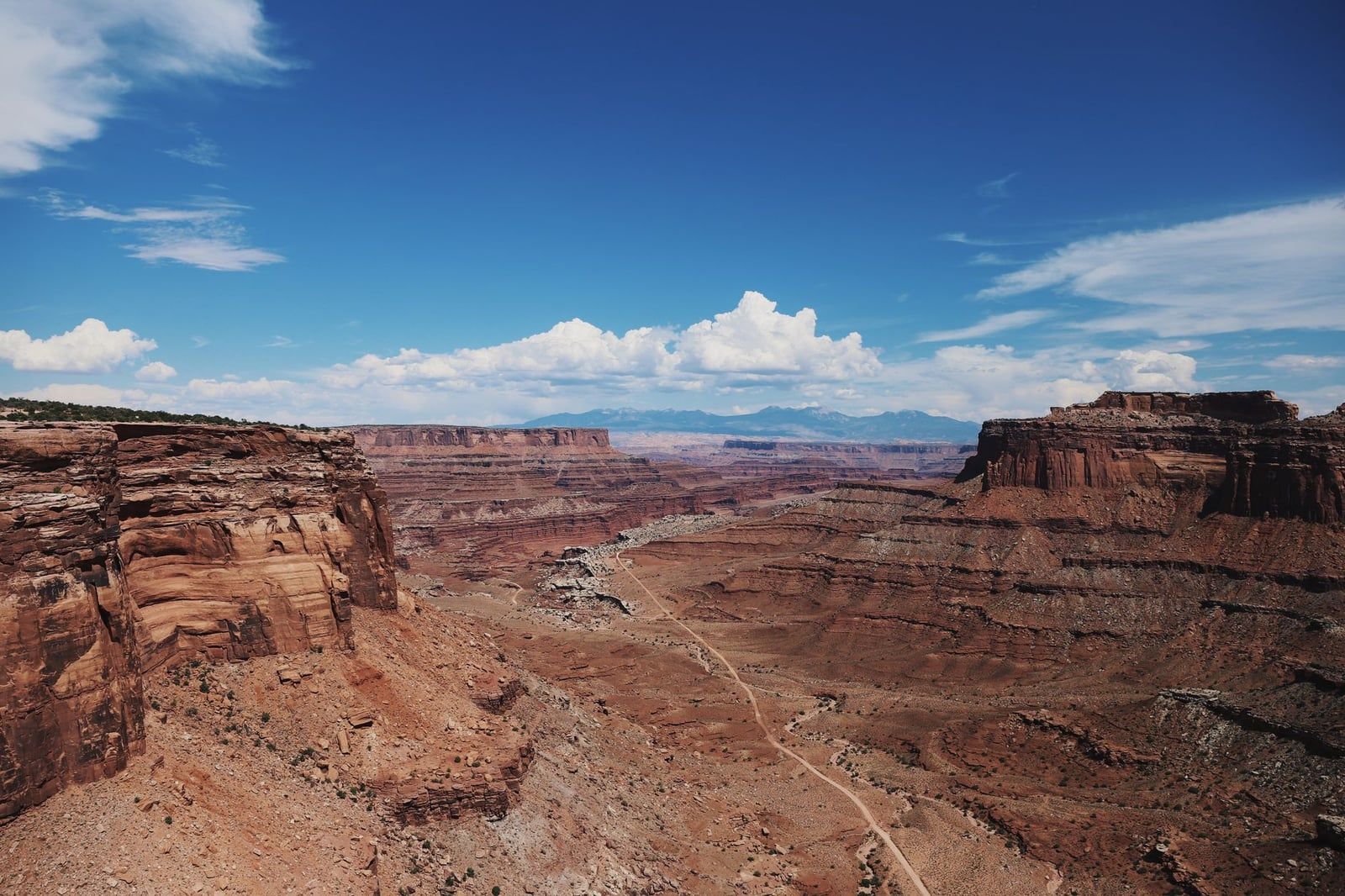
Straight down is the White Rim Road, the 99-mile four-wheel-drive loop that traces the bench of White Rim Sandstone between the mesa top and the rivers. From 1,200 feet up, the 4WD traffic looks like ants on a ledge. Watch long enough and you'll see why the road needs a permit and low-range gearing — the switchback descents off the rim are visible from here.
South, more than 15 miles away, the striped sandstone spires of the Needles district rise out of the canyon floor — if the park's other districts intrigue you, our guide to the Needles covers what that side offers. West and northwest, the canyon system of the Green River and the burnt-orange walls of the Orange Cliffs lead the eye toward The Maze, the least-visited corner of the park (see our Maze guide before you get ideas). On clear days the La Sal Mountains sit on the eastern horizon, snow-capped well into spring.
Closer in, look for Junction Butte, the massive flat-topped formation at the confluence area of the Colorado and Green Rivers — the two rivers meet inside the park, and the interpretive sign points out roughly where. The Totem Pole, a slender rock spire, is another named feature the sign will help you pick out. Give the view twenty minutes; the canyon changes character as the light moves across it.
Getting There: Directions, Parking, Fees & Facilities
From Moab, drive 10 miles north on US-191, then turn onto UT-313 and follow the signs for Dead Horse Point and Canyonlands for another 22 miles to the Island in the Sky entrance. The visitor center comes first; Grand View Point is another 12 miles south, at the very end of the road. Budget about 45 minutes from Moab. One caution from the park service: don't trust your GPS on this route — navigation systems sometimes send drivers the wrong way, so keep a map handy. Our Moab-to-Canyonlands drive guide covers the route in detail.
Parking is the part that ruins visits. The lot was built in 1973 and last expanded in the mid-1980s, and it holds just 44 formal spaces. On busy days 40–50 cars park along the roadside shoulder — a symptom of a park whose visitation has more than doubled since the 1990s. Arrive before 9 a.m. or after 5 p.m. and you'll walk straight in; arrive at midday in April and you'll circle.
Entry costs $30 per private vehicle, $25 per motorcycle, or $15 per person on foot or bicycle, and the pass is good for 7 days — full details are on our Canyonlands hours and fees page. The America the Beautiful pass ($80) and the $55 Southeast Utah pass both cover entry. Entrance stations take credit and debit only. At the trailhead you'll find vault toilets and space for RVs and trailers, but nothing else: there is no water and no food sold anywhere in the park, so fill bottles and buy lunch in Moab.
Hiking the Grand View Point Trail: Overlook, Rim Walk & the Final Point
Do you need to hike the whole trail? Not necessarily. Think of the experience in three tiers and pick the one that fits your time, your legs, and the temperature.
Tier one is the paved overlook: a roughly 100-yard sidewalk from the parking lot to the main viewpoint, wheelchair and stroller accessible. If your Island in the Sky visit is compressed to a couple of hours, this delivers the complete panorama — the canyons, the White Rim, the Needles — without a single step of effort. The park service's own one-hour itinerary counts Grand View Point as the stop, not the trail.
Tier two is the rim trail, about a mile each way past the overlook to a second viewpoint. It starts with a set of carved stairs, then runs across slickrock marked by stone cairns — the route is flat but poorly defined in spots, so keep an eye on the next cairn. As you walk, the mesa narrows until canyons drop away on both sides of you. That narrowing is the reason to come: the final stretch has you standing on a peninsula of rock with nothing but air in three directions. The crowds vanish at the overlook, so even on a packed day the trail feels close to empty.
Tier three is the final perch: a short scramble up a large rock at the trail's end, one or two easy moves on solid sandstone. From the top you get the park's best seat. It's not exposed climbing, but it does require hands, so anyone shaky on rock should be happy one tier down. However far you go, the view barely changes for the first half mile — you can turn around anywhere and still feel like you got the full experience. Short on time? Ten minutes out and back gets you most of it.
Trail Difficulty, Safety & Accessibility
This is a genuine all-ages hike: flat, short, and easy to follow once you know to hop cairn to cairn. Kids handle it without complaint. Grandparents handle it without complaint. It pairs naturally with the other short mesa-top walks in our Canyonlands hiking guide if you want a fuller day.
The edge is the thing to respect. There are no guardrails anywhere on the rim, and the mesa edges are undercut in places — rock that looks solid from above may not be. Keep children within arm's reach and stay well back from the edge; people who are prone to vertigo report that the drop feels real here, because it is. The point stands roughly 1,200 feet above the White Rim Road. A slip is not survivable.
Accessibility splits cleanly at the overlook. Wheelchairs and strollers work on the paved path and nowhere beyond it — the stairs and slickrock rule them out. Dogs are prohibited on every trail in this district, including carried ones; leashed pets are allowed only in campgrounds, on paved roads, and in parking lots. And the black, lumpy soil along the trail is living biological crust, decades in the making — walk on bare rock, never on the crust, and leave the cairns where they stand. Carry all your water; none is available at the trailhead or anywhere past the visitor center spring through fall.
Best Time to Visit Grand View Point (and Beating the Crowds)
Sunset is the signature experience. The low light rakes across the layered canyons and turns the whole view gold, and the parking crunch eases as day-trippers head back toward Moab. Bring a headlamp — the walk back along the rim trail after dark is genuinely dark, and the road out is unlit for 30 miles.
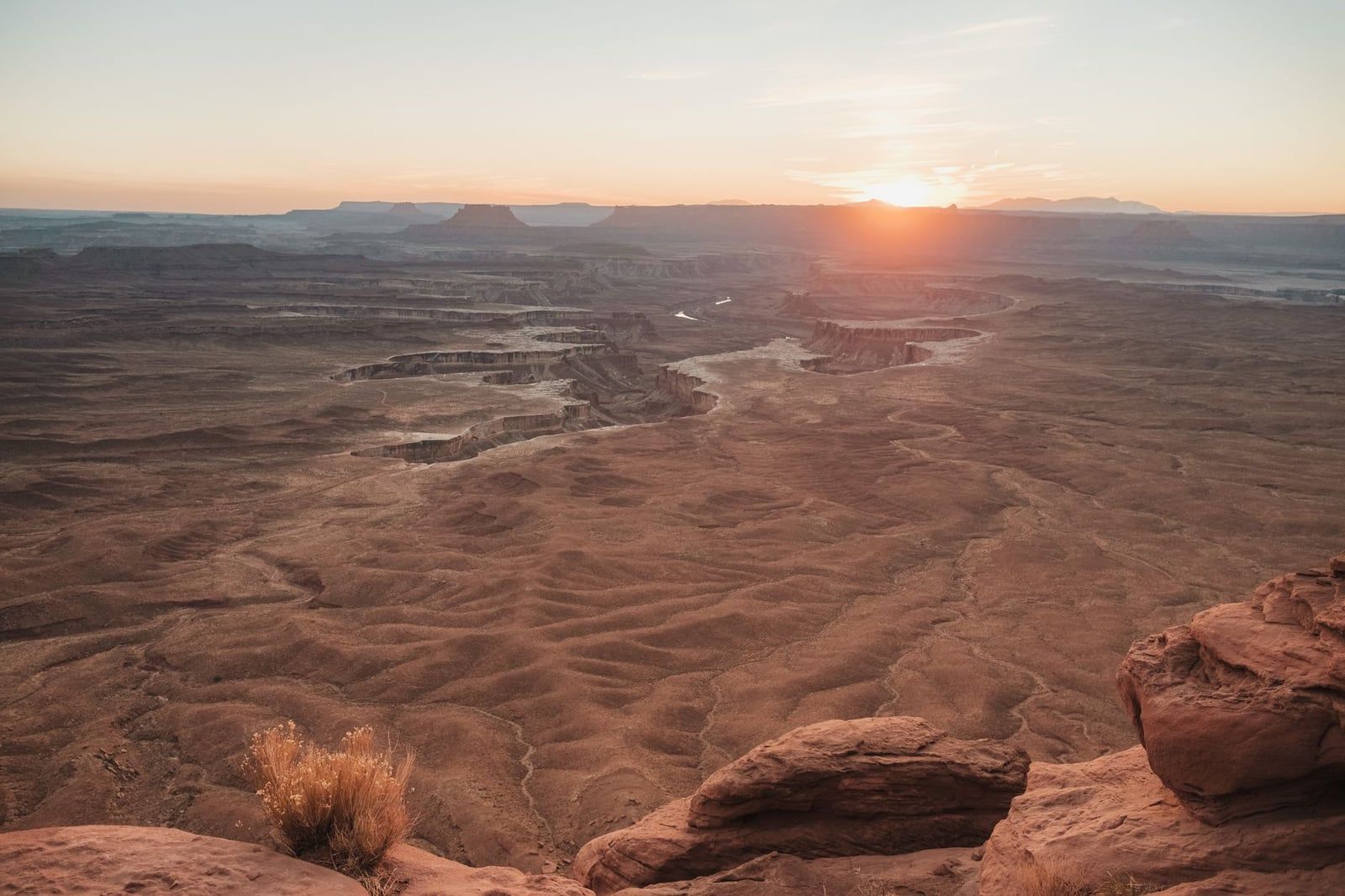
Sunrise, oddly, is the secret. Nearly every photographer in the park is at Mesa Arch for dawn, so Grand View Point sits nearly empty in the early morning — one December visitor at 8 a.m. reported having the place to herself. If you want solitude more than golden-hour color, set an alarm.
By season: spring and fall are ideal, with daytime highs of 60–80°F and October standing out for its low wind. Winter is cold (lows of 0–20°F) but empty, and a dusting of snow on the red rock makes for photographs you can't get any other month. Summer is the season to skip — average July highs hit 100°F with almost no shade, and rangers responded to 23 heat-related rescues across Arches and Canyonlands in one recent summer. If July or August is your only window, walk the rim at dawn, not midday.
Crowd tactics, in order of effectiveness: arrive before 9 a.m., walk past the overlook where the herd thins to nothing, or come for sunset. Between late July and early October 2026, add one more — the construction schedule means the area is open from 4 p.m. Thursday through Sunday, making Friday to Sunday the reliable days and weekday evenings the sleeper option. Ranger geology talks happen at the point spring through fall and are worth timing a visit around; ask at the visitor center for the schedule.
Pairing Grand View Point With the Rest of Island in the Sky
Grand View Point should be your last stop of the day, for two reasons. It sits at the dead end of the road, so nothing is beyond it, and it faces the setting sun — the same canyons that look flat at noon look carved at 6 p.m. Build the day so the mesa's other attractions come first and you arrive here in the best light with the best parking odds. Our Island in the Sky guide covers all the stops in depth.
A proven one-day order:
- Island in the Sky Visitor Center — maps, water, ranger talk schedule.
- Shafer Canyon Overlook — a short detour on the way in, right after the entrance road's cliff-hugging climb.
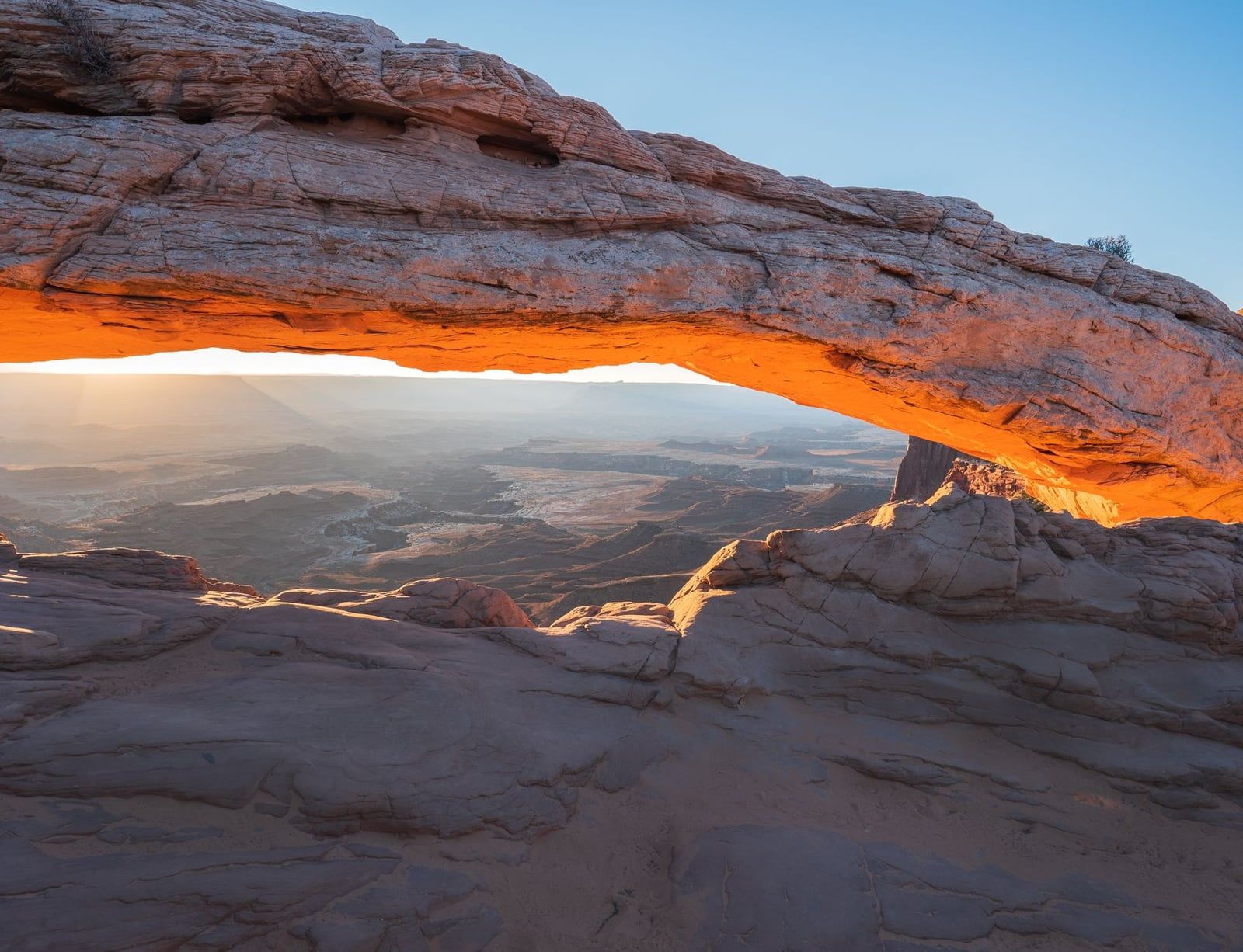
- Mesa Arch — the 0.5-mile loop; go early if you want the sunrise glow.
- White Rim Overlook — an easy 1.8-mile round trip along the mesa's west rim.
- Picnic lunch — there's no food for sale in the park, so pack it in Moab.
- Aztec Butte or Upheaval Dome — the mesa's sturdier hikes, if legs allow.
- Grand View Point for sunset — the finale, with a headlamp in the pack.
On the drive back out, two overlooks sit conveniently on the return route: Green River Overlook, with its view of the Green River's entrenched meanders, and Buck Canyon Overlook, a few minutes' pull-off. Both take ten minutes and both earn it. If you still have daylight, Dead Horse Point State Park sits on UT-313 just outside the park entrance — its overlook, where the Colorado River loops 2,000 feet below, is among the most photographed in the country, and entry is a separate $20 per vehicle. It's a natural final stop on the drive back to Moab, and its dark-sky designation makes it a good stargazing detour if you've stayed for the sunset.
Frequently asked questions
How long is the Grand View Point Trail in Canyonlands?
About 2 miles round trip (sources log 1.8–2.0 miles), mostly flat with 70–127 feet of gain — roughly an hour at a relaxed pace. The paved overlook alone is a 100-yard walk from the parking lot.
Can you drive to Grand View Point?
Yes. It sits at the very end of the Island in the Sky scenic drive, 12 miles south of the visitor center and about 45 minutes from Moab via US-191 and UT-313. The overlook is a short walk from the parking lot.
Is the Grand View Point overlook worth it if I don't want to hike?
Yes. A paved, wheelchair- and stroller-accessible path of roughly 100 yards reaches the main overlook, and the full panorama is visible from there. The rim trail beyond just adds more angles on the same canyons.
Is Grand View Point better at sunrise or sunset?
Sunset is the signature — golden light across the layered canyons and easier parking. But sunrise is the insider move: the crowds gather at Mesa Arch for dawn, leaving Grand View Point nearly empty.
Is Grand View Point closed in 2026 or 2027?
Partly. Phase 3 parking-lot construction closes the overlook, trail, and last 0.3 mile of road from 6 a.m. Mondays to 4 p.m. Thursdays, July 27–October 1, 2026; it reopens Thursday afternoons and all weekend. A final phase is scheduled July–September 2027. Check the NPS construction page before your trip.
Are dogs allowed at Grand View Point?
No. Pets are not allowed on any trail in Canyonlands' Island in the Sky district, at overlooks, or in the backcountry — not even carried. Leashed dogs are permitted only in campgrounds, on paved roads, and in parking lots.
How high is Grand View Point, and how dangerous is the edge?
The point stands roughly 1,200 feet above the White Rim Road below. There are no guardrails and the edges are undercut in places, so keep children close and stay well back from the rim.
What should I see after Grand View Point?
On the drive back out: Buck Canyon Overlook, Green River Overlook, White Rim Overlook, Mesa Arch, and Upheaval Dome. Dead Horse Point State Park sits just outside the entrance on UT-313 and pairs naturally with the return to Moab.