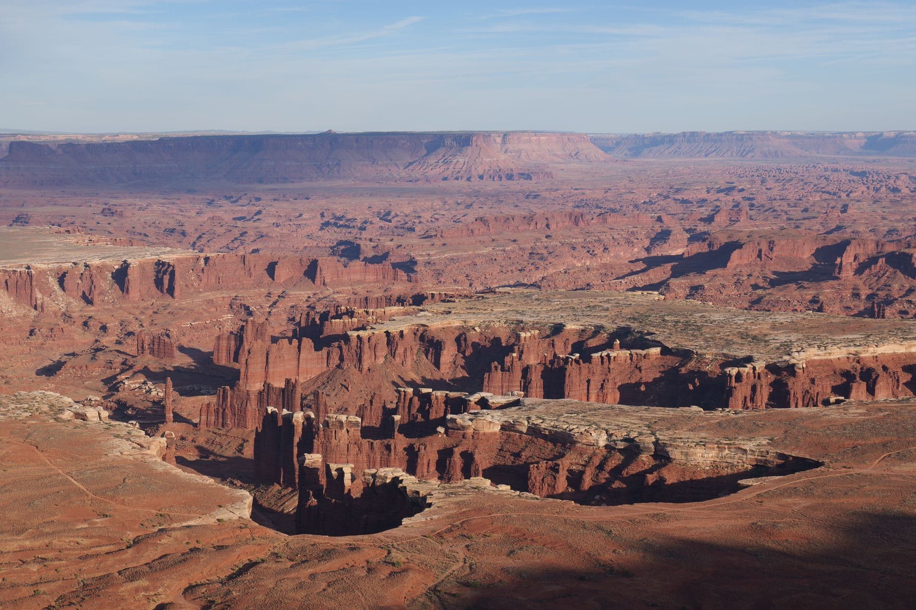
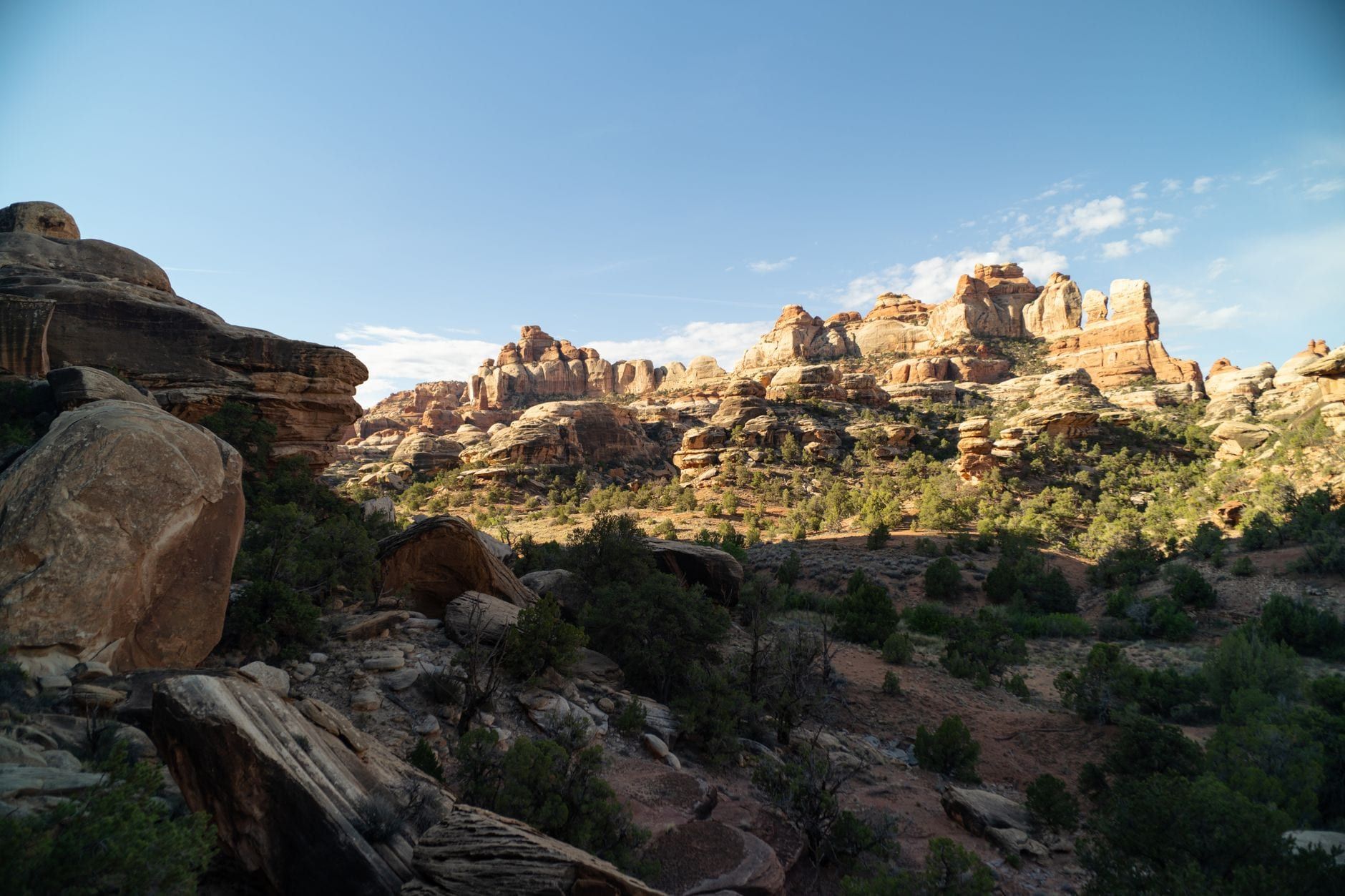
Canyonlands National Park's southeast corner is a maze of red-and-white striped sandstone spires, and almost all of it is reachable only on foot. That's the deal with the Needles: the district hides the park's best trail network behind a 90-minute drive from Moab, past the last gas pump and past the last bar of cell signal. The reward is Chesler Park's grassland ringed by hundreds of fins, a slot canyon you walk through rather than past, and crowds thin enough that you'll hear wind instead of car doors.
This guide covers the decision first — whether the drive justifies itself — then the logistics: routes, fees, permits, camping, water, and the hike ladder from a half-mile stroll to a 16-mile day. If you're still assembling the bigger picture, start with the park's history and layout, then come back here.
What Is the Needles District of Canyonlands?
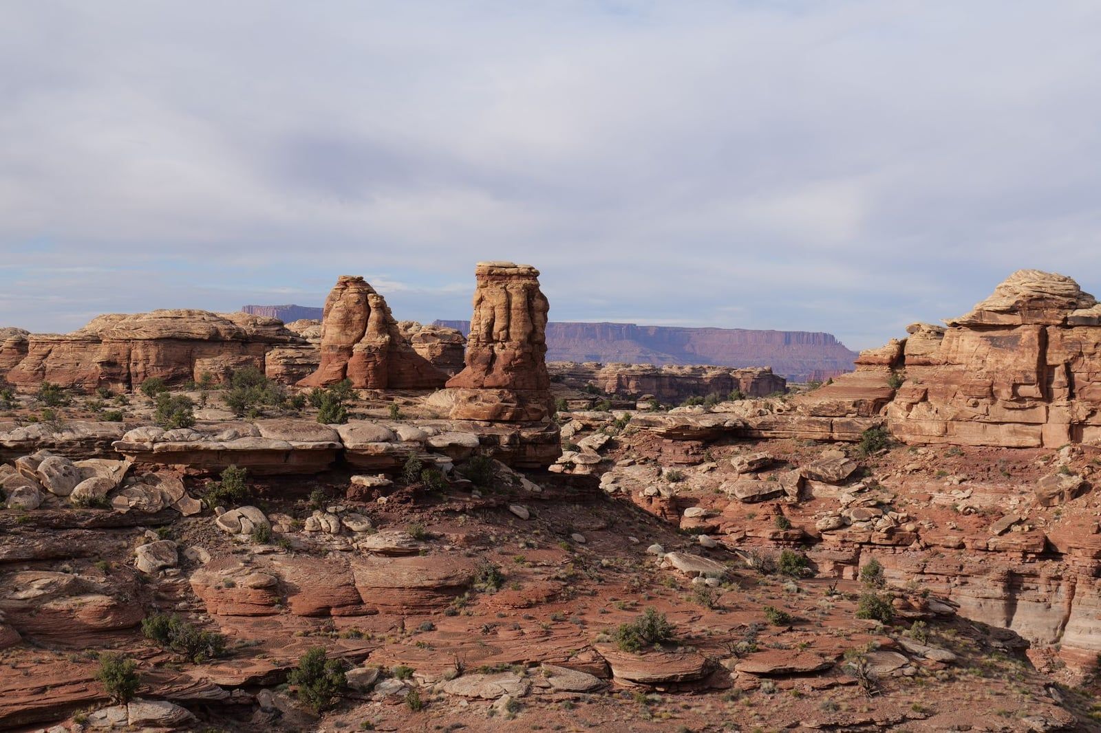
The Needles takes its name from the banded spires of Cedar Mesa Sandstone that cover its backcountry — columns of cream and rust rock stacked like organ pipes, some hundreds of them visible from a single overlook. The district forms the park's southeast corner and sits at the higher, wetter end of Canyonlands: elevations reach 7,180 feet above Big Pocket, and pinyon-juniper woodland replaces the bare slickrock you may know from postcards.
Those postcards come from elsewhere. Canyonlands, established in 1964 and now 337,598 acres, splits into four districts — Island in the Sky, the Needles, the Maze, and the river corridors — divided by the Green and Colorado Rivers and connected by no roads at all. Island in the Sky delivers rim-top overlooks a few steps from parking. The Needles asks you to walk. And the Maze asks for a week and a talent for route-finding. The Needles ranks second in visitation but draws a fraction of Island in the Sky's crowds, because its remoteness filters out everyone except people who came to hike.
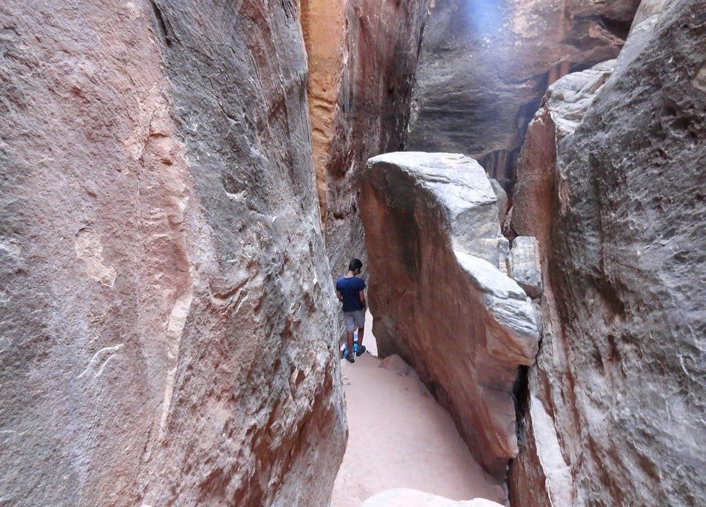
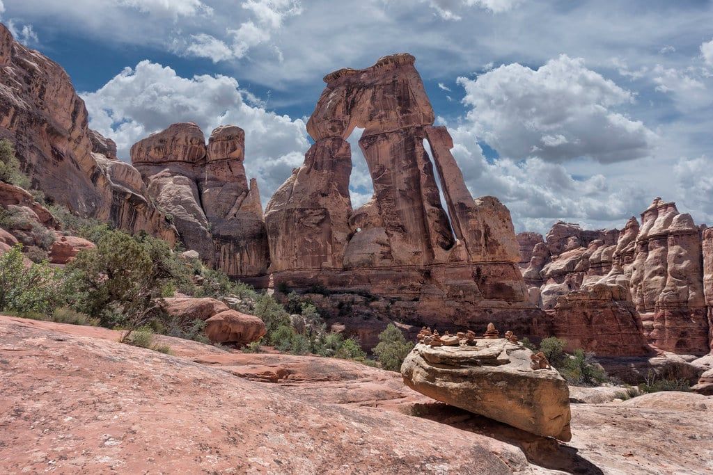
What you meet by trail: Chesler Park, a grassy basin enclosed by the spires; Druid Arch, a massive span at the head of Elephant Canyon; the Joint Trail, a slot section between walls 40 feet tall and as narrow as 3 feet; and Cave Spring, where a 19th-century cowboy camp still sits under a ledge beside Ancestral Puebloan handprints. Almost none of it is visible from pavement.
Is the Needles Worth the Drive?
Here are the hard numbers: Island in the Sky's visitor center is 15 miles from the Needles' as the crow flies, but 107 road miles by car. From Moab, Island in the Sky takes roughly 45 minutes; the Needles takes about an hour and a half to an hour forty-five. So the district costs you a minimum of three hours of driving on any day you visit it, and the two districts can't be combined in one morning.
Hikers, backpackers, and photographers chasing solitude: go, and don't deliberate. Sixty-plus interconnecting trail miles with route combinations you can't get anywhere else in the park, and trailhead lots that fill — not jam. If you can give the district a full day, the drive pays for itself by mid-morning.
Skip it if you can't hike far or you're short on time. Island in the Sky's pull-off overlooks deliver more scenery per hour than the Needles' road does, and its short walks (Mesa Arch, Grand View Point) fit a half-day schedule. Mountain bikers should also know the famous singletrack sits near the Maze, not here. For a deeper comparison, read our guide to Island in the Sky.
| Island in the Sky | The Needles | |
|---|---|---|
| Drive from Moab | ~45 min from Moab | ~1.5 hrs from Moab |
| Scenery access | Overlooks a few steps from parking | Spires reached only on foot |
| Typical hike length | Short walks, 0.5–2 miles | Long hikes, 5–16 miles |
| Crowds | Park's busiest district | Second-most visited, far fewer people |
| Best for | Short on time, non-hikers, first visit | Hikers, backpackers, solitude-seekers |
The verdict in one line: one full day minimum for the Needles, two if you want both the Chesler Park loop and Druid Arch, or a 4WD road. A half day barely gets you past the drive.
Getting to the Needles
From US 191, turn onto UT 211 — 40 miles south of Moab or 14 miles north of Monticello — and drive about 35 miles west to the park boundary. UT 211 is the only paved road in or out, winding through the Indian Creek corridor and Bears Ears National Monument country, where climber trucks stack up below wingate-crag walls and cottonwoods mark the creek. Monticello, 14 miles from the turnoff, is the closest town with fuel and food. For the broader route picture, including drive times from Arches and further afield, see Moab to Canyonlands.
Trust a map, not your GPS. The National Park Service explicitly warns that navigation units frequently send drivers astray on routes to the Needles, and there's no cell service to fix a bad reroute. Download offline maps in Moab and keep a paper map in the glovebox.
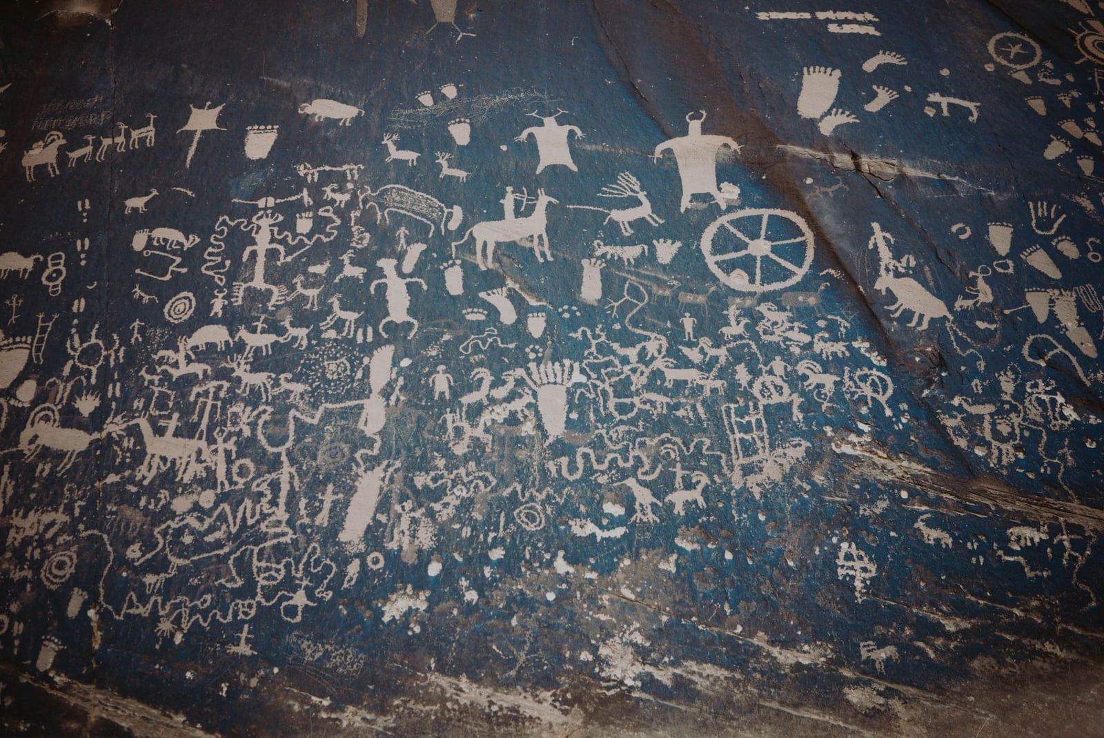
Budget twenty minutes for Newspaper Rock State Historic Monument, on UT 211 shortly before the park. A 200-square-foot sandstone panel holds hundreds of petroglyphs carved over roughly 2,000 years by Fremont, Ute, and Ancestral Puebloan hands — wheels, bighorn sheep, riders on horseback — all visible from a viewing platform, no hiking required. It's one of the densest rock-art walls in the Southwest and it sits five minutes off your route.
At the end of UT 211, the Needles Visitor Center (open daily spring through fall, 9 a.m.–4 p.m., closed December through February) has exhibits, an orientation video, backcountry permits, and the district's only year-round water. Evening ranger programs run at the campground April 7–June 1 and September 15–November 9. Inside the park, a paved road runs roughly 7 miles from the visitor center to Big Spring Canyon Overlook, serving every trailhead and the campground along the way.
Short Hikes and Roadside Stops
You can sample the Needles without committing to a big day. The short trails below run off the paved park road in roughly the order you'll pass them, and together with the overlooks they fill a pleasant two or three hours. For more options across all districts, browse our Canyonlands hikes guide.
Cave Spring Trail: 0.6 miles
This loop packs more per mile than anything else in the district. You'll climb two wooden ladders over slickrock ledges, pass an intact 19th-century cowboy camp — bedrolls, cookware, and tools still laid out under the ledge, left from when ranchers ran cattle here until 1975 — and stand in front of handprints and pictographs left centuries earlier. Kids love the ladders; adults linger at the rock art. Go early, since the spring area has the only real shade on the route.
Roadside Ruin and Wooden Shoe Arch
Roadside Ruin is a 0.3-mile loop to a remarkably well-preserved Ancestral Puebloan granary tucked under a sandstone lip, with trailside signs explaining how it was built and used. Ten minutes, flat, worth it. Further along the road, Wooden Shoe Arch Overlook is exactly what it sounds like: a roadside pull-off facing an arch shaped like a wooden clog, no walking involved.
Pothole Point
A roughly 0.6-mile loop across slickrock pocked with depressions that hold water after rain. Each pothole is a complete micro-ecosystem — fairy shrimp, tadpole shrimp, larvae — and the whole point of the trail is to leave them intact. Don't touch the water, don't wade in, don't draw from them: skin oils and sunscreen kill what's living there. After a storm, this becomes the most interesting quarter mile in the district.
Slickrock Foot Trail: 2.4 miles
If you have time for only one short walk, make it this one. The trail starts near the end of the park road and climbs onto bare slickrock, following painted markers across the dome for overlooks in every direction — the spires, Big Spring Canyon, and the country south toward Beef Basin. It's rated easy, though the exposure means sun protection matters more than fitness.
Big Spring Canyon Overlook
The road ends here, at a rail and a wide view down into Big Spring Canyon's cut, with the Confluence Overlook trail heading off along the rim to the east. Come at golden hour if you can: the banded rock goes from rust to deep red in about fifteen minutes, and you'll likely share the railing with two people instead of twenty.
The Big Hikes: Chesler Park, Druid Arch, and the Joint Trail
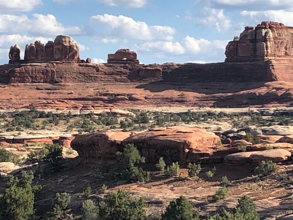
The Needles runs on one trail system: more than 60 miles of interconnecting routes, marked by cairns rather than signs, that let you stitch together anything from a 5-mile out-and-back to a multi-day loop. Nearly all the marquee routes start at one place — the Elephant Hill Trailhead — so the smart way to plan is as a ladder: pick your rung by fitness and daylight. One warning before anything else: the trailhead parking lot routinely fills by 8 a.m. spring through fall. Arrive early or you're walking extra miles before you've started.
Rung 1: Chesler Park Overlook, 5.4 Miles Round Trip
The shortest route that actually delivers the goods. You climb over Elephant Hill's slickrock, drop into Elephant Canyon's sandy wash, then rise to a saddle where Chesler Park opens below: a grassland a mile across, ringed completely by the striped spires that named the district. Roughly 1,000 feet of rolling gain, half a day at a relaxed pace, and a payoff that most visitors to Canyonlands never see.
Rung 2: Chesler Park Loop with the Joint Trail, ~10.4 Miles
The signature day hike. From the overlook you descend into the meadow and circle it, connecting through the Joint Trail on the way back — the section everyone remembers. For a quarter mile the route drops into a joint in the rock: a slot between walls up to 40 feet tall, narrowing to about 3 feet, with sky as a stripe overhead and your shoulders brushing both sides. Expect roughly 1,200–1,900 feet of cumulative gain, lots of it in short slickrock pitches. Allow six to seven hours with breaks.
Rung 3: Adding Druid Arch, ~16 Miles Total
Here's the planning trap competitors keep missing: Druid Arch is not a short add-on. The spur from the Chesler Park loop runs up Elephant Canyon and adds about 4 miles, turning your 10.4-mile day into a 16-mile one. Hiked alone via Elephant Canyon it's a 10.4–11-mile round trip with around 1,600 feet of gain. The arch itself is enormous — a thick, leaning span at the canyon head — and the final quarter mile earns it: a ladder climb followed by a scramble up a boulder-choked ravine. Combine all three only with a dawn start, big water, and legs you trust.
The Alternative: Confluence Overlook, ~10 Miles
The other big day hike starts at Big Spring Canyon Overlook and runs roughly 10 miles round trip east along the rim to the point where the Green and Colorado Rivers merge, 1,000 feet below. No spires, no slot — instead you get the scale shot: two rivers braiding into one canyon in the middle of a wilderness you can see but not reach. It's the district's most rewarding non-Elephant-Hill hike and a good pick when the trailhead lot is hopeless.
Splitting It Over Two Days: Backpacking
Backpacking is the classic way to do the full circuit without a 16-mile day. Overnight permits are required, reserved via recreation.gov (a $36 reservation fee plus $5 per person per night; reservations open up to four months ahead, groups up to 8). Two hard rules: carry all your water in — there is none that's reliable anywhere in the backcountry — and pack out human waste in wag bags. Sites near Chesler Park book fast for spring and fall.
4WD Roads and Permits
About 50 miles of challenging backcountry roads web through the Needles, reaching campsites, trailheads, and features no passenger car can visit. This is unusual for a national park — and it comes with paperwork.
The permit rule is the one to burn into memory: day use of the Elephant Hill road requires a permit, even if you're in and out the same day. Reserve on recreation.gov at 8 a.m. mountain time the day before your trip ($6 per vehicle), or pick one up free at a visitor center the same day. The permits are limited, which is why they sell out in peak season. Overnight trips on the same roads fall under the backcountry permit system described above.
Elephant Hill
The marquee route, and one of the most technical 4WD roads in any national park. It's a staircase of slickrock ledges and tight switchbacks, including a squeeze between two large rocks with a reputation for collecting paint from wider vehicles — the rangers are not joking when they recommend a narrow, short-wheelbase, high-clearance rig and an experienced driver. The reward is landing at trailheads deep inside the spires, including the Joint Trail's back door and campsites at Devil's Kitchen along Devil's Lane, with far less hiking to reach the best country.
Colorado River Overlook Road
A roughly 14.1-mile round trip over deep sand to a dramatic, unfenced view of the Colorado River below the district's south rim. It's the easier of the two named routes — sand and clearance rather than ledges — but it still needs the same day-use permit and a vehicle that won't high-center. Check the park's road conditions page before committing; a wet week changes everything.
Camping and Where to Stay
There's no lodging in the park, so your real choices are the in-park campground, nearby BLM sites, or a base town. In spring and fall, decide this part of the trip early.
Needles Campground
Twenty-six sites at $20 a night, with running water, toilets, and picnic tables — no hookups, no dump station, and a 28-foot maximum combined vehicle length at most sites. Some sites are reservable on recreation.gov spring through fall; Loop A stays first-come, first-served year-round. From late March through June and again early September to mid-October, expect it to fill every day. If you arrive without a reservation, be at the campground by mid-morning or earlier.
Group sites sit near the main campground, and pricing is tiered by headcount: the main Needles group sites run $90–$225 per night for 11–50 campers, Wooden Shoe runs $70–$115 for 11–25, and Split Top is $70 for 11–15. All are reservable on recreation.gov.
BLM Sites Outside the Park
If the campground is full, two Bureau of Land Management campgrounds along UT 211 — Creek Pasture and Hamburger Rock — offer about ten sites each at $15 a night, cash or check, first-come first-served. Both have vault toilets but no water. Free dispersed camping along Lockhart Road stretches the budget further. These fill too on spring weekends, so treat them as a backup rather than a plan.
Base Towns: Moab or Monticello
Moab has the restaurants, gear shops, and the airport-region convenience, at the cost of the full 1.5-hour drive each way. Monticello is the closest town and makes the morning commute short, but it's small and quiet — book ahead for anything nicer than a motel. Either way, top off the tank before UT 211: the Needles Outpost, just outside the park boundary, is the only source of gas, snacks, and supplies anywhere near the district, and its prices reflect that.
Know Before You Go
Entry costs $30 per private vehicle, $25 per motorcycle, or $15 per person on foot or bike — each valid seven days and covering all four Canyonlands districts, with no timed-entry reservation needed. Children 15 and under are free, entrance stations take credit and debit only, and the $55 Southeast Utah pass adds Arches, Natural Bridges, and Hovenweep if you're touring the region. Full details live on our hours and fees page.
| Item | Cost | Notes |
|---|---|---|
| Private vehicle | $30 | 7 days, all occupants, all districts |
| Motorcycle | $25 | 7 days, all districts |
| Per person (foot/bike, 16+) | $15 | 7 days; children 15 and under free |
| Southeast Utah annual pass | $55 | Canyonlands, Arches, Natural Bridges, Hovenweep |
| America the Beautiful pass | $80 | All federal recreation lands for a year |
When to Go
April through May and mid-September through October are the sweet spots: daytime highs of 60–80°F, cold nights, and every trail in season. July and August are brutal — average July highs hit 100°F with almost no shade, plus afternoon monsoon storms that bring flash-flood risk to the canyons; if summer is your only window, start at dawn and be off exposed slickrock by early afternoon. Winter buys you total solitude at the price of freezing nights, occasional snow or ice shutting the entrance road, and a visitor center that's closed December through February. Water at the visitor center runs year-round regardless. Our best-time-to-visit guide has the month-by-month detail.
Safety and Logistics
Assume you're on your own. There is no cell coverage anywhere in the Needles — download offline maps and carry paper, tell someone your route, and note the pay phone outside the visitor center. No trail in the district has water; the park recommends about a quart per person for every two to three hours of hiking, which works out to a gallon a day in summer heat. Dogs are prohibited on all trails, at all overlooks, and in the backcountry — leashed walks on paved roads and in the campground only — so plan boarding in Moab if you're traveling with one.
Dress for a 40-degree daily swing, which spring and fall deliver regularly. That means sun protection that stays on — hat, sunscreen, sunglasses — plus a layer you'll want at the trailhead at 7 a.m. and shed by 9. Sturdy shoes matter more than in most parks: the routes are cairn-marked paths over slickrock, loose rock, and deep sand, not constructed trail. And bring more water than feels reasonable. Every summer, rangers haul out hikers who thought otherwise.
Nearby Attractions to Pair with the Needles
The long drive to the Needles makes more sense as part of a loop than an out-and-back. Island in the Sky is the natural pairing — but note it's about two hours between the two visitor centers, and Mesa Arch at sunrise plus Grand View Point are its signature stops, so the pairing really wants two days. Arches National Park sits roughly an hour and a half away for a two-park Moab base.
Dead Horse Point State Park, on UT 313 between Moab and Island in the Sky, gives you a 2,000-foot-down view of the Colorado River's gooseneck for a $20 day-use fee and pairs well with either district. South of the Needles, Natural Bridges National Monument — the world's first International Dark Sky Park — holds three huge natural bridges (Sipapu, Kachina, Owachomo) and intact cliff granaries, reachable from a loop drive with short trails. For assembling the full itinerary, our things-to-do rundown covers the whole park.
Whatever you attach to the trip, keep the Needles' one rule in view: this district gives back exactly what you put in. Show up for a windshield tour and it will feel like a long drive to a modest overlook. Show up at dawn with water and boots, and it's the best hiking in Canyonlands.
Frequently asked questions
Is the Needles District worth the drive from Moab?
Yes, if you hike. The Needles holds the park's best trail network — 60-plus interconnecting miles — with a fraction of Island in the Sky's crowds. The cost is about 1.5 hours each way, so plan on a full day. If you can't hike more than a couple of miles or only have a few hours, Island in the Sky's roadside overlooks deliver more per hour.
How many days do you need in the Needles?
One full day covers the short trails plus one big hike, topping out around 16 miles if you combine Chesler Park, the Joint Trail, and Druid Arch. Two days let you split those routes or add backpacking and a 4WD road. A half-day visit spends most of its time on the drive.
Which is better: Island in the Sky or the Needles?
For short-on-time visits and non-hikers, Island in the Sky: easy overlooks, short walks, 45 minutes from Moab. For hikers and backpackers, the Needles: longer and more rewarding routes, the spires up close, far fewer people. No road connects them — about 107 road miles and two-plus hours between the two visitor centers.
Do you need reservations or permits to visit the Needles?
No timed entry or entrance reservation — you can drive in any day with the $30 vehicle fee. You do need permits for overnight backcountry trips ($36 reservation fee plus $5 per person per night, via recreation.gov), day-use permits for 4WD roads like Elephant Hill ($6 online the day before, or free same-day at a visitor center), and spring-through-fall campground reservations if you want a guaranteed site.
Are dogs allowed in the Needles District?
No. Dogs are prohibited on all trails, at overlooks, in the backcountry, and in buildings; leashed pets are allowed only in the campground and on paved roads and parking lots. If you're traveling with a dog, arrange boarding in Moab.
Is there cell service in the Needles?
No — the district has no cell coverage, and GPS directions are known to fail on the approach roads. Download offline maps before leaving Moab and carry a paper map. Water is available year-round at the visitor center, and the Needles Outpost just outside the park is the last place for gas or food.
What is the best hike in the Needles?
The Chesler Park Loop with the Joint Trail, about 10.4 miles and up to 1,900 feet of rolling gain from the Elephant Hill Trailhead — a grassland ringed by spires plus a slot section between 40-foot walls as narrow as 3 feet. Adding the Druid Arch spur brings the day to roughly 16 miles. For a short standout, Cave Spring's 0.6-mile loop has ladders, a cowboy camp, and rock art.
Can you visit the Needles in a regular car, or do you need a 4x4?
A regular car reaches all the main sights. UT 211 and the paved park road take you to the visitor center, the short-trail trailheads, the overlooks, and the Elephant Hill Trailhead parking area. High-clearance 4WD is only needed for the backcountry roads — Elephant Hill, Devil's Lane, and the Colorado River Overlook route — and those require a day-use permit.