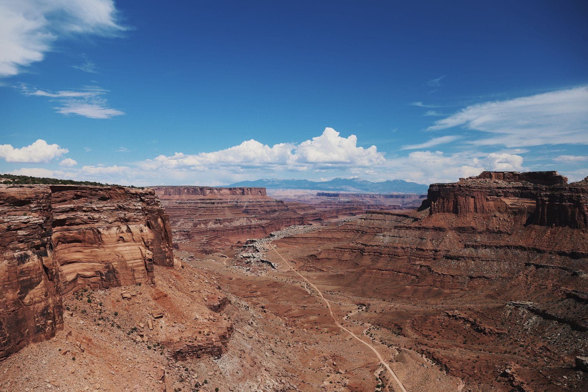
The Maze is the district Canyonlands barely mentions in its brochures: a roadless knot of canyons in the park's southwest corner, west of the Colorado River and south of the Green, pressed against the Orange Cliffs Unit of Glen Canyon National Recreation Area. About 12,000 people a year make it in — fewer than Island in the Sky logs in two busy weeks. That ratio is the whole point. Nobody comes here for a scenic drive.
The name is literal. Drainages in the Maze branch, fork, and dead-end without warning, and from the bottom of any given canyon there are no landmarks to orient by — every wall looks like the last one. People who have done long trips here report going four days without seeing another human. The National Park Service is blunt about what that means for you: because of the remoteness and the roads, visitors rarely spend fewer than three days in the district, and a week fills easily.
Why the Maze Is Canyonlands' Wildest District
Canyonlands is split into four districts — Island in the Sky, the Needles, the Maze, and the river corridors — and no road connects them inside the park. The rivers do the dividing. The Maze sits on the far side of both, which is why a place that's roughly 162 road miles from Moab feels like a different expedition entirely from the paved overlooks 40 minutes out of town.
Solitude here is quantifiable. One six-day May trip counted ten people total, rangers included, and saw no one at all for the first four days. On a spring weekend the Maze holds a handful of visitors; Island in the Sky holds hundreds per day. If you want the darkest, quietest version of the Colorado Plateau, this is where it lives.
Nights are half the argument. Canyonlands is a Gold-Tier International Dark Sky Park (designated 2015), and the Maze's distance from any town makes its night skies among the darkest in a park that already ranks near the top in the contiguous U.S. Multi-day trippers describe the Milky Way casting faint shadows on the sandstone.
What the Maze does not have is a trail network. One route — the Maze Overlook Trail — is formally defined. Everything else is cross-country travel over slickrock and through branching drainages, navigated by topo map, compass, and the occasional cairn. The district's character follows from that single fact.
Getting to the Maze: Routes, Roads & Realistic Drive Times
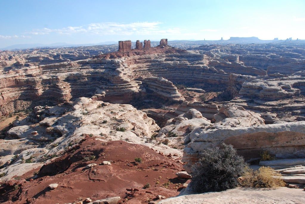
The standard approach runs from I-70 to UT-24, then 46 miles of unpaved clay road southeast to Hans Flat Ranger Station — about 2.5 hours from Green River, Utah. From the station, the canyons themselves are another 3 to 6 hours by high-clearance, low-range 4WD. Count a full day from Moab just to reach the interior; one measured run to the Doll House came out at roughly nine hours.
The access road is the trip's first hazard. It's clay, and clay becomes impassable when wet — a rainstorm can strand you for days, and the NPS road conditions page exists for exactly this reason. Once you're past Hans Flat, interior jeep trails crawl along at about 5 mph, and the district sits roughly 100 miles from the nearest services. Check conditions the morning you commit.
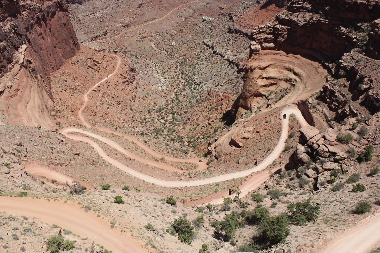
The northern alternative enters off UT-95 near Hite Marina, on Lake Powell — 3+ hours of 4WD just to reach the park boundary. It's an option for trips looping in from the south or west, not a shortcut.
Hans Flat Ranger Station
Hans Flat is the logistical anchor: open 8 am–4 pm daily, with a small books-and-maps sales area and staff who know which springs are currently flowing. There's no water, food, or gas at the station, and none anywhere else in the district either. For trip-planning help before you go, call the Hans Flat area office at 435-719-2218, weekdays 8–4 MT. Nearest amenities are Hanksville (20 miles) or Green River (37 miles) from the UT-24 junction.
Where a 2WD Car Fits In
A two-wheel-drive vehicle can usually reach Hans Flat when the road is dry. Every road past the station requires real 4WD — high clearance, low range, and a driver who has done this kind of driving before. The 2WD compromise is to park near the station and hike about 15 miles to Maze Overlook, roughly half a day of walking each way. It's a legitimate plan, and people do it, but it converts a driving itinerary into a backpacking one.
The River Option
The other way in is by water. A jet-boat shuttle (Tex's Riverways) runs about two hours down the Colorado to Spanish Bottom — around $250 per person round trip — from which a trail climbs more than 1,000 feet up the canyon wall to the Doll House. Packrafters cross from the Needles side via the Lower Red Lake Canyon Trail from Elephant Hill. Both approaches trade vehicle risk for river logistics and make 4–6 day itineraries the natural length.
Permits, Fees & Backcountry Rules
Every overnight trip in the Maze — on foot, by 4WD, or by mountain bike — requires a backcountry permit. Day use does not. Permits cost a $36 non-refundable reservation fee (which includes the $6 recreation.gov charge) plus $5 per person per night, refundable if you cancel at least three days out.
The release calendar is what actually decides your trip. Permits go live on recreation.gov four months before each season, at 8 am Mountain Time: spring (Mar 10–Jun 9) opens November 10, summer (Jun 10–Sep 9) opens February 10, fall (Sep 10–Dec 9) opens May 10, and winter (Dec 10–Mar 9) opens August 10. Spring dates in the Maze vanish fast. Reservations close two days before a trip start, after which unreserved sites go walk-up at visitor centers until 2:30 pm.
Group limits in the Maze are the strictest in the park: 5 people per backpacking permit, and 9 people / 3 vehicles for 4WD and mountain-bike groups (Island in the Sky allows 15 people). An overnight permit covers up to 14 consecutive nights — 7 maximum in a single backpacking site or zone, 3 at a vehicle camp before you must relocate. Vehicle and bike groups stay in designated sites; backpackers may use designated sites or at-large zones.
The Maze has no staffed entrance station, so no fee is collected there — but the standard Canyonlands entrance fee ($30 per private vehicle, valid 7 days) applies park-wide, and the America the Beautiful pass is accepted. Rules that catch people off guard: ATVs, UTVs, and OHVs are prohibited outright (motorbikes must be highway-legal), and pets are banned from hiking trails and 4WD roads — even riding inside a vehicle on one.
Trails & Routes: What You Can Actually Hike
There is exactly one formally defined trail in the Maze. The Maze Overlook Trail runs 3.9 miles round trip, is rated strenuous, and includes a rope-assisted pitch descending into the canyon below sparse cairns. From the overlook itself you get the classic view: the district's branching canyons stacked to the horizon. Beyond that trailhead, NPS requires a USGS 1:24,000 topo map and compass — GPS as backup only, because units regularly lead people astray here.
The rest of the Maze is route-finding. The 4WD road network functions as a trailhead system: descend the Flint Trail, walk the Chocolate Drops and Standing Rocks jeep roads, and strike off cross-country from there. Steep slickrock and drop-offs are standard, and the NPS warns that many routes assume them. A wrong turn in a branching drainage is how day plans become overnight ones.
Experienced parties plan trips around named travel zones — Land of Standing Rocks, Ernies Country, the Doll House, Pictograph Fork, Pete's Mesa, and the Chimney Route. Backpacking itineraries run 3–4 days minimum driving in, and 4–6 days comfortably via the jet-boat approach; one six-day route totaled 62 miles, about 10 miles a day. Day-hiking the interior from outside the district is effectively impossible — the approach alone eats the day.
Water shapes the route more than scenery does. A handful of springs anchor the classic itineraries — Lou's Spring and Water Canyon Spring among them — but reliability changes season to season, and some run dry or carry water too silty to filter. Confirm current conditions with the rangers at Hans Flat before you build your plan around them.
The Landmarks Worth Building a Trip Around
These are the places Maze itineraries are built around. Each one takes real effort to reach, which is precisely why the district's landmarks stay uncrowded decades after the park's paved districts went mainstream.
The Doll House
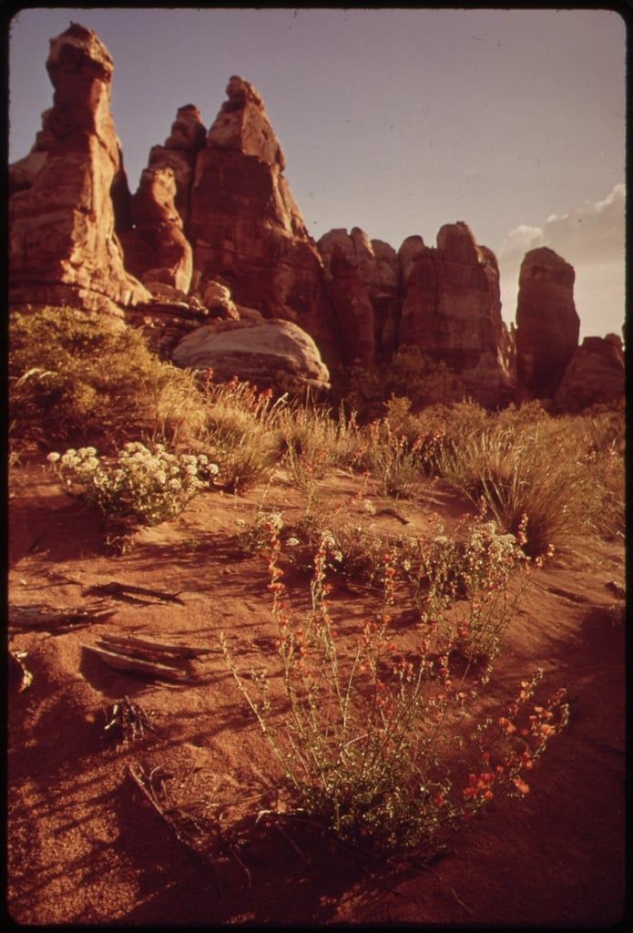
Towers of Cedar Mesa Sandstone stand in rows like organ pipes, the district's signature skyline. Reach it either by the 1,000-foot climb up from Spanish Bottom or via the interior 4WD roads through Surprise Valley, threading squeezes between sandstone fins on the way in. It's where most jet-boat trips base their first and last nights.
Maze Overlook
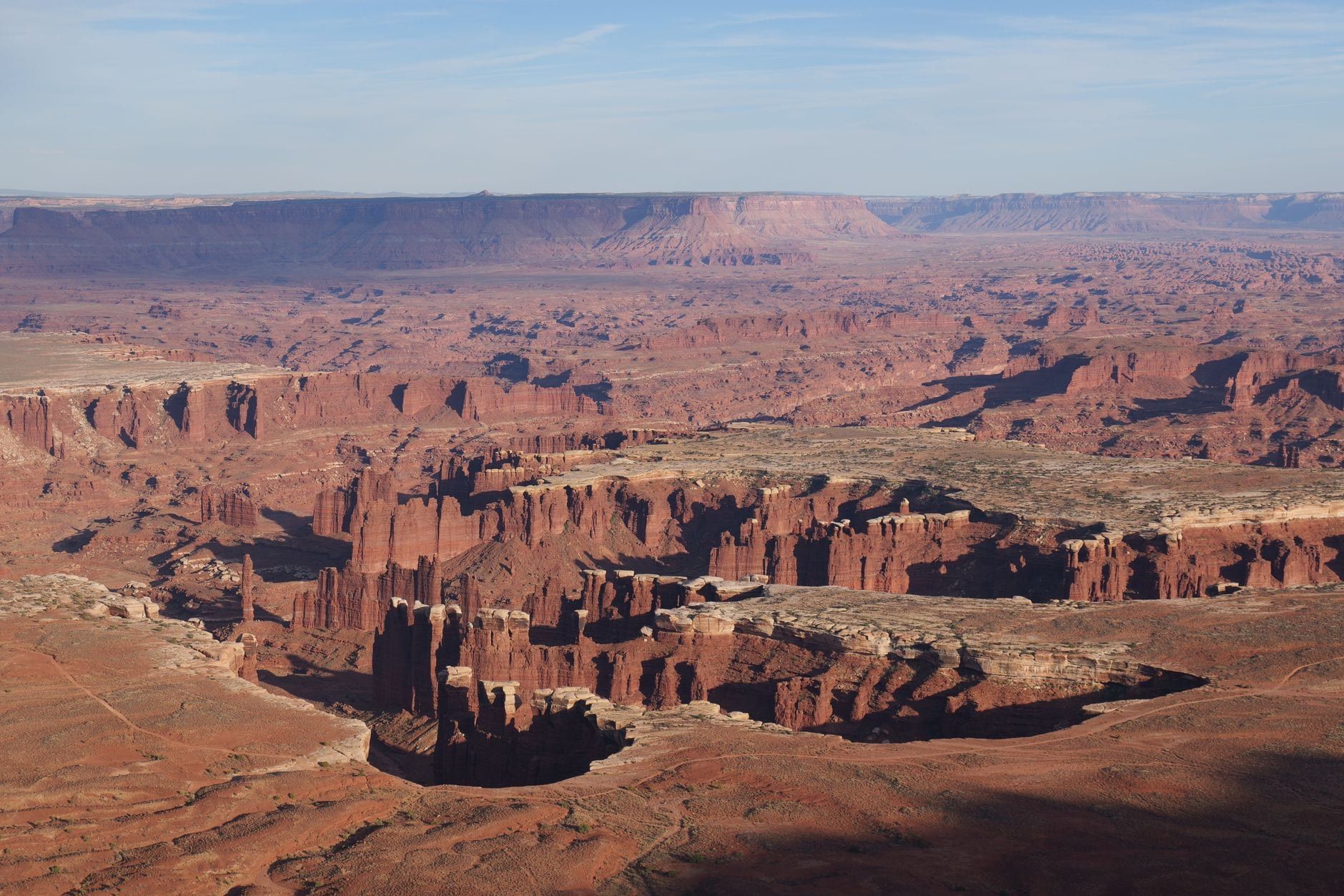
The overlook is the one view most 4WD day-trippers target, and it earns the drive: the full labyrinth of branching canyons below, with the Chocolate Drops visible to the north. It's also the top of the district's only maintained trail, so it's where defined route meets cross-country travel.
Land of Standing Rocks
A broad ridge on the Organ Rock Formation — dark red siltstone caprock over Cedar Mesa sandstone — studded with named formations: Standing Rock, Lizard Rock, The Plug, The Wall. Walking the ridge separates the shallower southern canyons from the deeper Maze to the north, and the jeep roads through it double as the district's main hiking arteries.
The Chocolate Drops and the Golden Stairs
The Chocolate Drops are Organ Rock pillars capped with contrasting White Rim sandstone, best seen from Maze Overlook. The Golden Stairs is the historic descent route into the northern Maze and one of the classic 4WD landmarks; its trailhead road is usually manageable for a stock 4WD at about 4.5 hours from Moab.
The Harvest Scene
In Pictograph Fork, roughly 500 feet of Barrier Canyon-style pictographs run along the canyon wall — life-size spectral figures and a harvesting scene, painted by people of a tradition that produced this art from roughly 2000 BCE to 500 CE. It's the district's premier rock art panel and, for many visitors, the single most memorable thing in the Maze. Reaching it is a committing route-finding hike, not a roadside stop.
Ernies Country, the Fins, and the Arches
The rest of the rewards go to navigators. Ernies Country and the fins of Sand Tank Canyon are route-finder's territory, and scattered side canyons hide Muffin Arch (Sweet Alice Canyon), Tibbett Arch, and Whitmore Arch, whose 64-foot span is the largest on some classic six-day loops. The Orange Cliffs along the western boundary and the Confluence Overlook make strong rim objectives on the district's edges.
Horseshoe Canyon: The (Relatively) Easy Day Trip
Horseshoe Canyon is the answer for the majority of this article's readers — the ones without a 4WD. It's administratively part of the Maze district, added to the park in 1971, and it holds some of the most significant ancient rock markings in North America. A regular car, driven carefully, can get you to the trailhead.
Access is a 30-mile graded dirt road off UT-24 near Goblin Valley, or a 47-mile dirt road from Green River — roughly 2.5 hours from Moab, 1.5 from Green River. Two-wheel-drive is usually fine when it's dry. Check the road conditions page before you go and don't trust a GPS unit; the same warning applies here as in the Maze proper.
The hike to the Great Gallery is 7 miles round trip, takes five hours or more, and starts with a steep 780-foot descent you'll climb back out at the end. The payoff: well-preserved, life-sized Barrier Canyon-style figures on a sheltered wall, among the finest rock art panels on the continent. Carry one gallon of water per person — there's none above the rim — and in summer the NPS flags this canyon as dangerously hot, so start very early or after 4 pm.
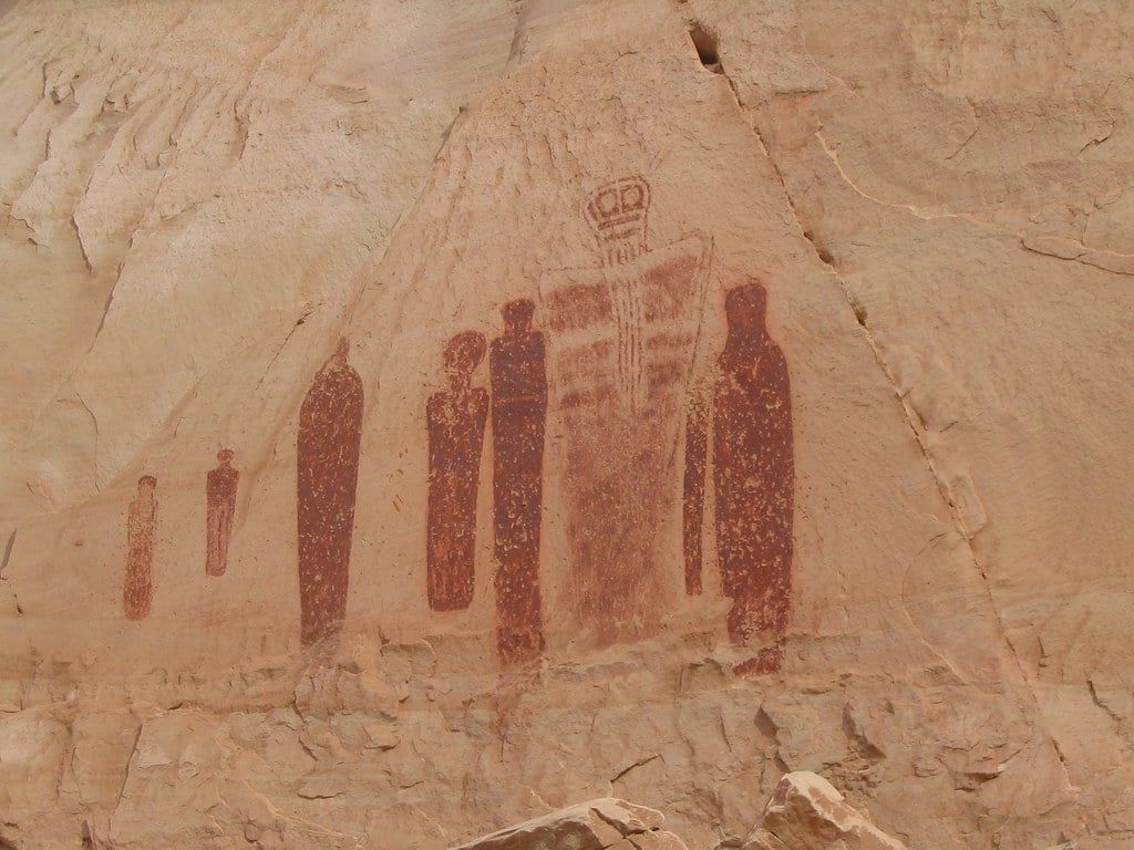
Rangers lead guided walks here most weekends in spring and fall — the same strenuous 7-mile outing, limited to 20 people per group. Call ahead at 435-719-2218 for the schedule. Camping isn't allowed inside the canyon within the park boundary, but BLM land at the west rim trailhead allows it, with a vault toilet and no water. Pets are prohibited on the trail and below the rim.
Water, Safety & Self-Rescue
There is no potable water, food, gas, or lodging anywhere in the Maze — not even at Hans Flat. Everything you consume comes in with you, and everything you need if something breaks comes in with you too. That's the deal.
The water math from a real six-day May trip: two gallons (about 16.5 pounds) carried from the start, with refills planned around springs known to run year-round — and even then, seasonal springs ran dry or were too dirty to filter. The NPS baseline is one gallon per person per day of activity; at a remote trip start, plan on two. Always filter, always confirm current spring status with Hans Flat rangers.
Navigation discipline is the other half of staying safe. Paper 1:24,000 topos and a compass are the primary tools; GPS is backup, and cell coverage is poor to nonexistent across the whole district. Rescue response here is measured in hours, not minutes — even with a satellite beacon, help would realistically take at least a full day. Carry a satellite messenger or PLB as standard kit, plus a real first-aid setup.
Heat is the constant. Summer temperatures regularly exceed 100°F, the canyon terrain amplifies it, and there is no shade — hydration discipline matters even in winter. For 4WD travelers, self-sufficiency extends to the vehicle: extra fuel, a full tire-repair kit, spares, and the sense that a solo breakdown here is a serious situation. If something goes wrong, the numbers you need are the Hans Flat area office (435-719-2218, weekdays 8–4 MT) and the backcountry permit office (435-241-3110, [email protected]).
Best Time to Visit the Maze
April–May is the prime window: moderate temperatures, the most reliable water in the canyons, and wildflowers. It's also the most competitive permit window — which means you're booking in November. September–October is the second window, with cooler air and excellent canyon light, though monsoon storms can linger into early September and the clay roads still shut down when they hit.
Skip summer, full stop — one veteran of the district advises not even considering June, July, or August. Temperatures top 100°F, there's no shade, and there's no water. Winter brings real solitude, but snow and ice close the clay access road in some years; call Hans Flat before planning anything between November and March.
Work backward from the permit calendar. If you want a May trip, you're on recreation.gov at 8 am MT on November 10. That four-month lead time — covered in our guide to the best time to visit Canyonlands — is the difference between your first-choice zones and leftovers.
Is the Maze Worth It? Who This Trip Is (and Isn't) For
Go if you're an experienced desert traveler with a capable 4WD (or a jet-boat budget), solid map-and-compass skills, and at least three days. What the Maze delivers isn't any single must-see sight — it's the isolation itself, plus landmarks like the Doll House and the Harvest Scene that you earned with effort. People who love it love it precisely because it demands something.
Don't go if this is your first Canyonlands visit, if you have one day, or if you don't have 4WD and backcountry gear. Those aren't dismissals — they're routing advice. The same canyon ecosystem is on display from paved overlooks at Island in the Sky, 32 miles from Moab, and the Needles at 74 miles offers a middle ground of dirt roads and short hikes. For how the park's districts stack up generally, see our park overview.
| The Maze | Island in the Sky | |
|---|---|---|
| Distance from Moab | ~162 miles, final 46+ unpaved | 32 miles, paved |
| Vehicle needed | High-clearance, low-range 4WD | Any car |
| Time required | 3+ days (a week easily) | 1 hour to half a day |
| Visitors | ~12,000 per year | Hundreds per day |
| Navigation | Topo map and compass, cross-country | Signed trails and overlooks |
You can also experience the Maze without driving it. No guided land tours operate into the district — but scenic flights from Moab overfly it (a sunset flight runs about $374), Cataract Canyon rafting trips run the river corridor along its boundary, and the Horseshoe Canyon day hike delivers the district's most accessible rock art. For more on the park's hiking overall, our Canyonlands hikes guide covers the rest.
A realistic timeline: pick your season, then reserve the permit the day it opens. Watch the NPS road conditions page the week before, build your water plan around confirmed springs, and file an itinerary with someone who will notice if you don't come back. Do that, and the least-visited corner of Utah's largest national park is yours — along with about eleven thousand other people a year, spread thin enough that you may never meet one.
Frequently asked questions
Can you visit the Maze without a 4WD vehicle?
You can reach Hans Flat Ranger Station via the 46-mile dirt road off UT-24, but every interior road requires high-clearance 4WD and takes 3–6 hours from the station. Without one, hike about 15 miles from the Hans Flat area to Maze Overlook, book a jet-boat shuttle to Spanish Bottom, or visit 2WD-accessible Horseshoe Canyon.
Do you need a permit to visit the Maze?
All overnight trips (4WD, bike, or on foot) require a backcountry permit; day use does not. Cost is a $36 reservation fee plus $5 per person per night on recreation.gov, with Maze group limits of 5 for backpacking and 9 people / 3 vehicles for 4WD groups. Permits release seasonally, four months ahead.
How long does it take to get to the Maze?
Count 2.5 hours from Green River to Hans Flat, then another 3–6 hours by high-clearance 4WD to the canyons. From Moab it's roughly 130 miles and 3–4 hours just to the ranger station — a full nine-hour day to the Doll House. The northern route off UT-95 near Hite is 3+ hours just to the park boundary.
Is the Maze worth visiting?
With the 4WD, navigation skills, and 3+ days required — yes. About 12,000 visitors a year make it one of the most remote places in the lower 48, with landmarks like the Doll House and the Harvest Scene. For a day trip or a first Canyonlands visit, Island in the Sky is the better fit.
What's the best time of year to visit the Maze?
Spring (April–May) and fall (September–October) have the moderate temperatures. Summer regularly exceeds 100°F with no shade or water, and winter snow and ice can close the clay access roads entirely.
Can you do the Maze as a day trip?
Not realistically. Day use needs no permit, but with 3–6 hours of 4WD crawling at about 5 mph each way and zero services, an in-and-out day is impractical. Choose Horseshoe Canyon (2WD, 7-mile round trip to the Great Gallery) or a scenic flight instead.
Is there drinking water in the Maze?
No. There is no potable water anywhere in the district, and springs are unreliable — many run dry or are too dirty to filter. Plan on at least one gallon per person per day, carry all you need, and confirm current springs with the rangers at Hans Flat.
Are there guided tours into the Maze?
No land-based guided tours operate into the district. Alternatives include jet-boat shuttles to Spanish Bottom (about $250 per person round trip), ranger-led Horseshoe Canyon walks in spring and fall, Cataract Canyon rafting trips, and scenic flights that overfly the Maze.
Are dogs allowed in the Maze?
No. Pets are prohibited on hiking trails and 4WD roads in the Maze, even inside a vehicle. Horseshoe Canyon's trail and below-rim areas are also pet-free.
Why is it called the Maze — how easy is it to get lost?
The district is named for its labyrinthine canyon system, where drainages branch repeatedly, dead-end without warning, and every canyon looks alike. The NPS warns that GPS units frequently lead people astray and requires topo map and compass skills for travel beyond the Maze Overlook trailhead.