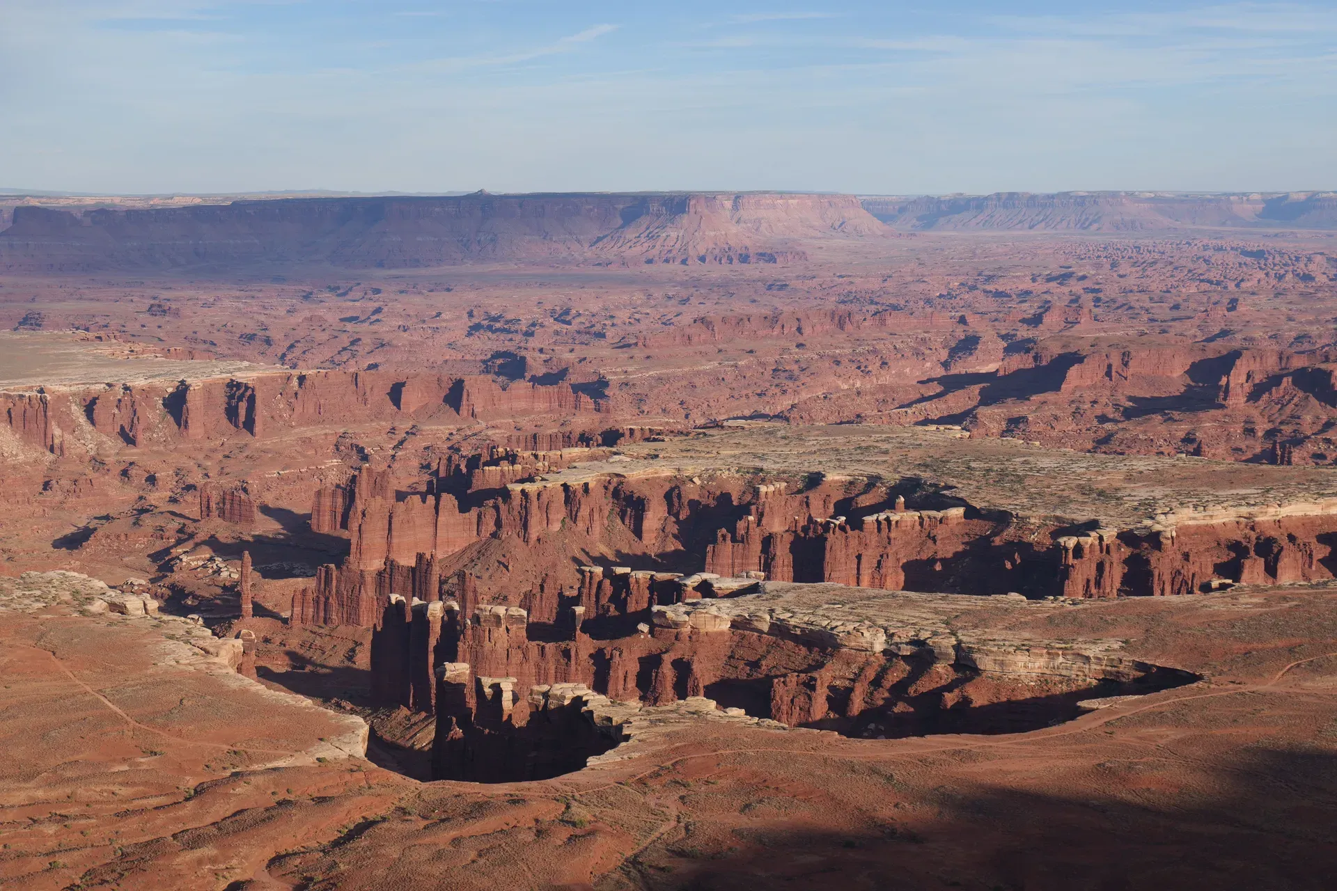
Canyonlands National Park is a 337,598-acre wilderness in southeast Utah where the Green and Colorado rivers have carved canyons, mesas, buttes, and spires into the Colorado Plateau. Utah's largest national park, it splits into four roadless districts — and its Island in the Sky mesa sits just 40 minutes from Moab.
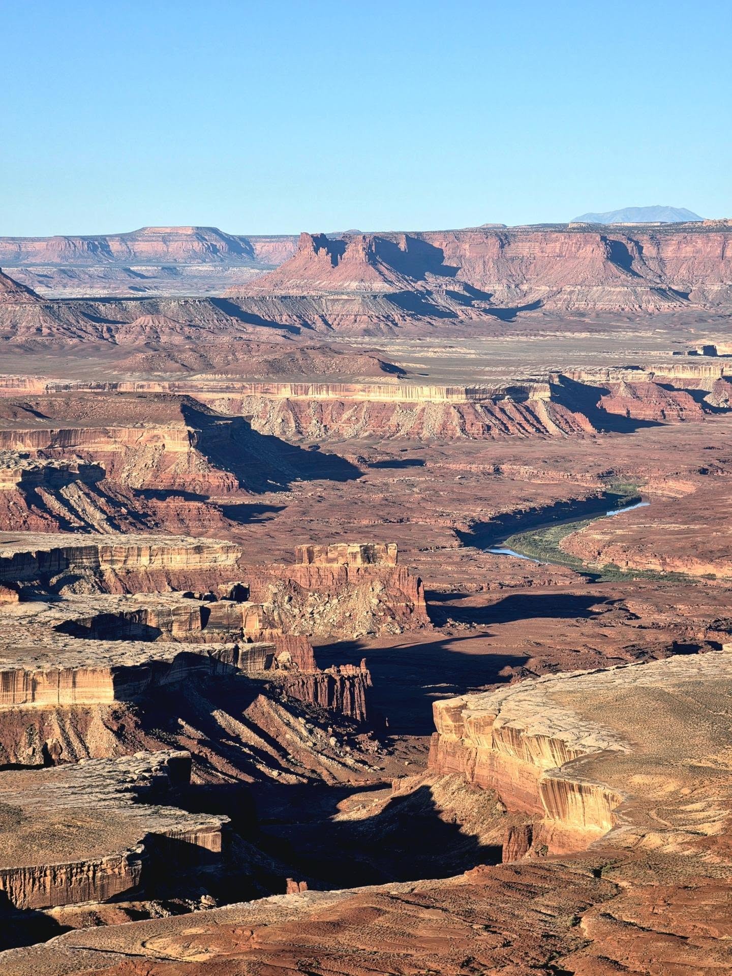
Canyonlands National Park protects 337,598 acres of southeast Utah canyon country, split by the Green and Colorado rivers into four districts that no road connects: Island in the Sky, The Needles, The Maze, and the river corridors themselves. It's Utah's largest national park, yet it received just 818,492 recreation visits in 2024 — fewer in a year than Arches gets in a fraction of that time. What draws people is the scale. From Grand View Point at the mesa's southern tip, canyons stack toward the horizon in every direction, The Needles to the south, The Maze to the west, and more than 1,000 feet of cliff dropping straight from the viewpoint's edge.
Island in the Sky is where nearly everyone starts. The mesa top sits at 5,930 feet, about 40 minutes from Moab, and its best overlooks are steps from the parking lots. Below the cliffs, the resistant White Rim Sandstone forms a broad bench encircled by a 99-mile four-wheel-drive road; below that, the rivers. The park's rocks record roughly 300 million years of deposition, and its archeology runs deep too — the Great Gallery in Horseshoe Canyon holds life-sized painted figures made between about 2000 BCE and 500 CE.
The park never closes, and no timed-entry reservation is required. Entry costs $30 per vehicle for seven days. Come April–May or mid-September–October, when daytime highs run 60–80°F; July averages 100°F, and monsoon storms bring flash floods to the canyons below the rim. Services inside the park amount to visitor centers, campgrounds, and toilets — carry your own water, food, and fuel, and fill up in Moab before you drive in.
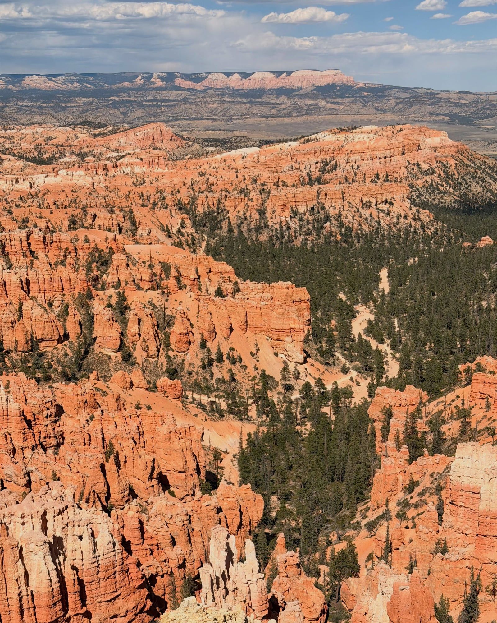
People have lived in this canyon country for more than 10,000 years, and they left a visible record. Hunters and gatherers of the Barrier Canyon tradition painted the life-sized figures of the Great Gallery in Horseshoe Canyon sometime between roughly 2000 BCE and 500 CE — ghost-like, armless forms that rank among the most significant rock art panels in North America. Later, Ancestral Puebloans built stone dwellings and left granaries in the canyons, and Ute and Navajo people moved through and used this land into the historic period. When you stand at an overlook, you're looking at a landscape with a human record five times longer than the park's own.
The 1950s uranium boom changed the region's geometry. Government incentives drew prospectors into the desert, and the roads they cut — including routes up onto Island in the Sky — foreshadowed the park's future road network. By the early 1960s, a coalition was pushing for protection: Bates Wilson, superintendent of Arches National Monument from 1949 to 1964, led trips through the canyons to win people over, while Moab guide Kent Frost showed the country to Senator Frank Moss of Utah and Interior Secretary Stewart Udall. Udall's support mattered; he flew over the confluence in 1963 and came away convinced.
Congress established Canyonlands National Park on September 12, 1964, at 257,640 acres — a compromise that left out land advocates had wanted. In 1971 the park grew to its present 337,598 acres, and the detached Horseshoe Canyon unit, home of the Great Gallery, was added. Today the park anchors southeast Utah's recreation economy: tourism to the Southeast Utah Group parks contributes about $447 million annually to local economies, with Moab, Monticello, and Hanksville as the gateway towns. Visitation passed 800,000 in 2024, still modest for a park this size — the four-district layout keeps the crowds spread thin.
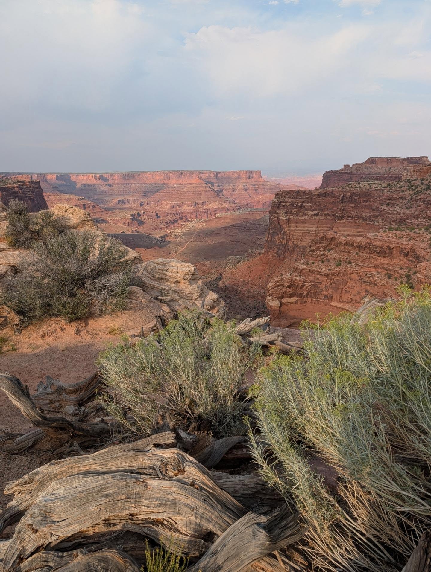
Nearly 300 million years of sedimentary rock — sandstone, shale, and limestone — lie stacked under the park, and water and gravity did all the carving. The Green River joins the Colorado near the park's center, and over millions of years the downcutting rivers left the surrounding plateau standing as three separate tablelands. Elevations run from about 3,900 feet on the Colorado River to 7,180 feet above Big Pocket in The Needles. Island in the Sky's mesa top sits at 5,930 feet on sheer sandstone cliffs more than 1,000 feet above the surrounding terrain — a flat island of pinyon-juniper woodland in a sea of canyons.
The park's signature landform is the White Rim. This resistant sandstone layer forms a broad bench between the mesa top and the rivers, and a 99-mile (160 km) four-wheel-drive road loops around it — a multi-day trip by high-clearance 4WD or mountain bike. Upheaval Dome, on the mesa's west side, is a broken bull's-eye crater roughly two miles across that scientists still can't agree on: one hypothesis says a buried salt dome collapsed, another says a meteorite hit. A steep 0.6-mile trail reaches the first overlook; the exhibits there lay out both arguments. In The Needles, erosion has carved the striped sandstone into the spires that give the district its name.
The climate is genuinely arid — 8.6 to 9.3 inches of precipitation a year — so plant life clusters where water does: pinyon-juniper on the mesa tops, Fremont cottonwood galleries along the rivers. That dryness buys something back at night. The park's dark desert skies make it a favorite for stargazing and astrophotography, and since the park never closes, you can stay for the Milky Way after the sunset crowd drives home. One planning fact shapes every itinerary: the districts sit two to six hours apart by car, so most visitors see only one per trip. Pick Island in the Sky unless you're a committed hiker or have days to spare.
For Indigenous peoples of the region, this land carries a record measured in millennia. The Great Gallery's life-sized painted figures — some of the most significant rock art in North America — were made by people of the Barrier Canyon tradition between roughly 2000 BCE and 500 CE, and Ute and Navajo presence followed. Touching or collecting artifacts, rock art, or even the stones of trail cairns is prohibited by federal law. Go to Horseshoe Canyon for the panel itself: a seven-mile round-trip hike descending 780 feet, at its best in cooler months.
The park also sits at a crossroads of Western exploration history. The confluence of the Green and Colorado rivers was a landmark for the historic exploration of the Southwest — the spot where two of the region's great rivers merge inside a canyon a thousand feet deep. For the people who mapped this country by boat and on foot, that junction was a navigational anchor, and it remains the park's geographic heart, reachable only by river or long hike.
Today Canyonlands is the backbone of southeast Utah's identity and economy. Tourism to the Southeast Utah Group parks contributes about $447 million a year to the local economy, and Moab — 40 minutes from Island in the Sky — has built itself into a full-service base for river trips, mountain biking, and the White Rim. The park's founders are remembered locally by name; Bates Wilson and Kent Frost campaigned for protection in the 1960s when the uranium boom had already scarred the region with roads. Visitors keep their own rituals too: sunrise photographers crowd the Mesa Arch loop at first light, and stargazers stay late under skies the park works to keep dark.
Upheaval Dome's origin is still contested. One hypothesis blames a collapsed salt dome; the other, a meteorite impact. Exhibits at the overlook present both, and researchers haven't settled it.
The rivers split Canyonlands into four districts separated by canyon with no roads between them. Driving from one district to another takes two to six hours — around the outside.
The Maze district is one of the most remote areas in the contiguous United States. Its Hans Flat Ranger Station is reachable only by long unpaved drives, and it has no pay phone.
The park's record high is 116°F and its record low is -16°F. July averages a 100°F daytime high, while winter lows typically fall between 0 and 20°F.
Canyonlands is open 24 hours a day, year-round, with no timed-entry reservation required. That makes it a favorite for astrophotographers — though lighting up the landscape with artificial light is banned.
Launching, landing, or operating unmanned aircraft anywhere in the park is prohibited — no exceptions for recreation or photography. Commercial filming needs a special-use permit.
Pets are banned from every hiking trail, overlook, and backcountry route. Leashed dogs are allowed only in campgrounds, on paved roads and parking lots, and on the Potash/Shafer Canyon road.
It's a 337,598-acre national park in southeast Utah — the state's largest — where the Green and Colorado rivers have carved a labyrinth of canyons, mesas, buttes, and spires into the Colorado Plateau. The rivers split it into four districts: Island in the Sky, The Needles, The Maze, and the river corridors. No roads connect the districts inside the park.
Congress established the park on September 12, 1964, at 257,640 acres, after a campaign by Senator Frank Moss, Interior Secretary Stewart Udall, Arches superintendent Bates Wilson, and local guide Kent Frost. Concern had grown as 1950s uranium prospectors cut roads across the canyon country. The park expanded to its current 337,598 acres in 1971, when the detached Horseshoe Canyon unit was added.
No. The park is open 24 hours a day, year-round, and timed-entry reservations are not required. You only need reservations for backcountry and river permits, day-use permits on certain 4WD roads like the White Rim, and group campsites at The Needles.
Island in the Sky, about 40 minutes from Moab. With one hour you can drive to Grand View Point; with two, add Green River Overlook and the Mesa Arch loop; with half a day, add mesa-top trails like Whale Rock or Upheaval Dome. Hikers with a full day might prefer The Needles instead, about 1.5 hours from Moab.
A 7-day private vehicle pass costs $30 and covers all occupants; motorcycles pay $25 and individuals on foot or bicycle (16+) pay $15. Children 15 and under are free. Entrance stations accept credit and debit only. The $55 Southeast Utah annual pass also covers Arches, Natural Bridges, and Hovenweep.
The Great Gallery in Horseshoe Canyon is one of the most significant rock art panels in North America. Its life-sized, ghost-like figures were painted in the Barrier Canyon style between roughly 2000 BCE and 500 CE. Reaching it requires a 7-mile round-trip hike with a steep 780-foot descent — five hours or more, and dangerously hot in summer.
Upheaval Dome is a broken, bull's-eye-shaped crater near Island in the Sky's west side, viewable via a steep 0.6-mile trail. Its origin is an open scientific question: competing hypotheses blame either a collapsed salt dome or a meteorite impact. A second overlook adds a mile to the hike.
No. The 99-mile loop requires a high-clearance four-wheel-drive vehicle with low range; all-wheel-drive and two-wheel-drive vehicles are not permitted. You'll also need a $6 day-use permit, and commercial towing for a disabled backcountry vehicle can exceed $1,000.
Very limited. Leashed pets (6-foot maximum) are allowed only in developed campgrounds, on paved roads and parking lots, and on the Potash/Shafer Canyon road. They're prohibited on all hiking trails, at overlooks, and in the backcountry — even carried in a vehicle.
Don't count on it. Coverage is limited in some areas and nonexistent in many, including the entire river corridor. Pay phones sit outside the Island in the Sky and The Needles visitor centers, but there are none at The Maze — carry a map and tell someone your itinerary.
Browse verified tours with free cancellation and instant confirmation.
Find Tours